
RESOLUTION NO. 23-77
WHEREAS, certain property has recently been annexed to the City of Huntsville, Alabama; and
WHEREAS, said property is now legally part of the incorporated mu- nicipality of the City of Huntsville, Alabama, and as such is subject to the laws and ordinances governing the City of Huntsville, Alabama; and
WHEREAS, said property, having been outside the boundaries of the City of Huntsville, Alabama, prior to the annexing of same to the City of Huntsville, Alabama, has never been subject to the Zoning Ordinances of the City of Huntsville, Alabama; and
WHEREAS, the Planning Commission of the City of Huntsville, Alabama, has given consideration to an amendment to the Zoning Ordinance, a synopsis of said amendment being as follows:
(1) The zoning of 3.47 acres of land lying on the north side of Winchester Rd and east of Bradford Ln. to Highway Business C-4 District.
2) The first publication of this resolution, this synopsis, and the ordinance hereinafter set out at length shall be in the Speakin’ Out News on the 22nd day of February, 2023, and the second publication shall be one week thereafter on the 1st day of March, 2023, both of which publications shall be at least 15 days in advance of the date of the public hearing hereinafter referred to.
WHEREAS, it is the judgement and opinion of the City Council of the City of Huntsville, Alabama, that consideration should be given to the adoption of an amendment to the Zoning Ordinance of the City of Huntsville, Alabama, in accordance with said request;
NOW, THEREFORE, BE IT RESOLVED by the City Council of the City of Huntsville, Alabama, as follows:
1. That the City Council of the City of Huntsville, Alabama, shall meet at 5:30p.m. on the 23rd day of March, 2023, in the Council Chambers of the City of Huntsville Administration Building at 308 Fountain Circle in the City of Hunts- ville, Alabama, for the purpose of holding a public hearing at which time and place all persons, parties in interest and cities who desire, shall have an opportunity to be heard in opposition to or in favor
of said Ordinance No. 23-78, which is introduced by the City Council of the City of Huntsville on the 9th day of February, 2023, amending the Zoning Ordinance of the City of Huntsville, Alabama.
2. That the proposed amendment to the Zoning Ordinance of the City of Huntsville, Alabama, is substantially in words and figures as follows:
ORDINANCE NO. 23-78
AN ORDINANCE TO AMEND THE ZONING ORDINANCES OF THE CITY OF HUNTSVILLE, ALABAMA
The public welfare requiring it, and under authority granted by Section 11-52-78 of the 1975 Code of Alabama, BE IT ORDAINED by the City Council for the City of Huntsville, Alabama, as follows:
1. That the following area, land lying on the north side of Winchester Rd and east of Bradford Ln., which area is a newly annexed area of the City of Huntsville, Madison County, Alabama, and which has not been zoned previously, shall be shown and classified on the Official Zoning Maps of the City of Huntsville, Alabama, as Highway Business C-4 District, in the Zoning Ordinances of the City of Huntsville, Alabama, said property being particularly described as follows:
All that part of Sections 34 and 35, Township 2 South, Range 1 east of the Huntsville Meridian, in the City of Huntsville, Madison County, Alabama, more particularly described as beginning at a point located at the Southeast corner of said Section 34; thence North 4 Degrees 53 Minutes 34 Seconds West 174.00 feet to a point; said point is further described as the Point of True Beginning; thence North 1 Degrees 3 Minutes 54 Seconds East 698.39 feet to a point; thence South 89 Degrees 6 Minutes 10 Seconds East 231.37 feet to a point; thence South 0 Degrees 11 Minutes 39 Seconds West 434.41 feet to a point; thence South 1 Degrees 50 Minutes 30 Seconds East 140.17 feet to a point; thence South 63 Degrees 26 Minutes 6 Seconds West 69.88 feet to a point; thence South 64 Degrees
5 Minutes 37 Seconds West 101.33 feet to a point; thence South 64 Degrees 30 Minutes 43 Seconds West 103.79 feet to the Point of True Beginning and containing 3.47 acres more or less.
2. The boundaries of the above district as described and defined above are hereby established and shall be shown on the Official Zoning Maps of the City of Huntsville, Alabama, on file in the Planning Division of the Urban Development Department, in accordance with the various classifications herein enumerated and hereafter the regulations governing said district under the Zoning Ordinance of the City of Huntsville, Alabama, shall apply to the area so described.
3. This ordinance shall take effect from and after the date of publication.
ORDINANCE NO. 23-78 (Cont.)
ADOPTED this the 9th day of February 2023.

APPROVED this the 9th day of February, 2023.

RESOLUTION NO. 23-77 (Cont.)
ADOPTED this the 9th day of February, 2023.
/s/ John Meredith
President of the City Council of the City of Huntsville, Alabama
APPROVED this the 9th day of February, 2023.
/s/ Tommy Battle
Mayor of the City of Huntsville, Alabama
RESOLUTION NO. 23-04
BE IT RESOLVED by the City Council of the City of Huntsville, within the State of Alabama, as follows:
1. That the Rocket City I, LLC, is the sole landowner abutting the property hereinafter described, made application for the vacation of a portion of that certain Right-of- Way more particularly described as follows (the “Right-of-Way” or the “Property”):
See Exhibit “A” attached hereto and incorporated herein.
2. That notice of the vacation of the Right-of-Way has been given as required by Section 23-4-1 et seq. of the Code of Alabama, 1975, as amended, and a public hearing held for purposes of allowing public comments on the proposed vacation before the City Council.
3. That after vacation of the designated portion of Right-of-Way and all public rights therein, convenient and reasonable means of ingress and egress to and from the respective property will be afforded to all property owners owning property in or near the Right-of-Way by the remaining streets, avenues, and highways.
4. That in the judgment and opinion of the City Council of the City of Huntsville that it is in the public interest and necessary and expedient that the City vacate the designated portion of Right-of-Way and that the vacation of the designated portion of Right-of-Way is in the best interests of the citizens of the City in that same will contribute to the health and general welfare of the citizens of the City of Huntsville, Alabama.
5. That the filing of the resolution with the Judge of Probate of Madison County, Alabama, shall operate as a declaration of the City’s vacation of that portion of the Right-of-Way as described herein and shall divest all public rights and liabilities, including any rights which may have been acquired by prescription, in that part of the Right-of-Way. Title and all public rights shall vest in the abutting landowner, Rocket City I, LLC.
6. That notice of this resolution shall be published in Speakin’ Out News no later than fourteen (14) days from the date hereof.
NOW THEREFORE, be it resolved by the City Council of the City of Huntsville that they do hereby assent to the said vacation of
the herein described portion of Right-of-Way and that the above de- scribed Property be and the same is hereby vacated and annulled and all public rights therein divested of the Property, with the City of Huntsville retaining a public utility and drainage Easements over, across and under subject property.
RESOLUTION NO. 23-04 (Cont.) ADOPTED this the 23rd day of February 2023.
APPROVED this the 23rd day of February, 2023.
EXHIBIT A
Right-of-way Vacation
STATE OF ALABAMA MADISON COUNTY
A PARCEL OF LAND SITUATED IN NORTHWEST QUARTER OF SECTION 1, TOWNSHIP 4 SOUTH, RANGE 1 WEST, MADISON COUNTY, ALABAMA, AND BEING MORE PARTICULARLY DESCRIBED AS FOLLOWS:
COMMENCING AT A FOUND 1⁄2-INCH IRON PIN ON THE NORTH MARGIN OF PELHAM A VENUE, SAID POINT BEING LOCATED SOUTH 1560.0 FEET AND WEST 982.0 FEET FROM THE CENTER OF THE NORTH BOUNDARY OF SECTION 1, TOWNSHIP 4 SOUTH, RANGE 1 WEST THENCE RUNNING NORTH 1 DEGREES 27 MINUTES WEST ALONG THE WESTERLY BOUND- ARY OF COUNCIL COURTS PROJECT NO. 47-1, A DISTANCE OF 99.75 FEET; THENCE LEAV- ING SAID COUNCIL COURTS BOUNDARY AND RUNNING SOUTH 81 DEGREES 58 MINUTES 18 SECONDS WEST 158.69 FEET TO A POINT ON THE NORTHERLY MARGIN OF THE NEW LOCATION OF DAVIS AVENUE, SAID POINT BEING THE POINT OF CURVA- TURE OF A CURVE TO THE LEFT HAVING A RADIUS OF 427.55 FEET, A DELTA OF 54 DEGREES 55 MINUTES 12 SECONDS, AND A CHORD BEARING OF NORTH 69 DEGREES 34 MINUTES 22 SECONDS WEST AND CHORD DISTANCE OF 394.31 FEET; THENCE, RUN ALONG THE ARCOF SAID CURVE A DISTANCE OF 409.82 FEET TO A POINT ON THE NORTHERLY MARGIN OF THE NEW LOCATION OF DA VIS A VENUE; THENCE CONTINUING ALONG THE NORTHERLY MAR- GIN OF DA VIS AVENUE SOUTH 82 DEGREES 58 MINUTES 03 SECONDS WEST 291.13 FEET TO A POINT, SAID POINT BEING THE POINT OF CURVATURE OF A CURVE TO THE RIGHT HA YING A RADIUS OF 100.00 FEET, A DEL- TA OF 33 DEGREES 33 MINUTES 20 SECONDS, AND A CHORD BEARING OF SOUTH 80 DEGREES 15 MINUTES 17 SECONDS EAST AND CHORD DISTANCE OF 57.73 FEET; THENCE, RUN ALONG THE ARC OF SAID CURVE A DISTANCE OF 58.57 FEET TO A POINT ON THE NORTHERLY MARGIN OF THE NEW LOCATION OF DA VIS A VENUE; SAID POINT BEING THE POINT OF CURVATURE OF A CURVE TO THE LEFT HA YING A RADIUS OF 50.00 FEET, A DELTA OF 81 DEGREES 23 MINUTES 10 SECONDS, AND A CHORD BEARING OF SOUTH 75 DEGREES 49 MINUTES 56 SECONDS WEST AND CHORD DISTANCE OF 65.20 FEET; THENCE, RUN ALONG THE ARC OF SAID CURVE A DISTANCE OF 71.02 FEET TO A POINT ON THE NORTHERLY MARGIN OF A CUL- DE-SAC AT THE WESTERLY END OF DA VIS A VENUE; THENCE LEA VINO THE NORTHERLY MAR- GIN OF SAID CUL-DE-SAC AND RUNNING SOUTH 06 DEGREES 15 MINUTES 59 SECONDS EAST 66.13 FEET TO THE SOUTHERLY MARGIN OF SAID CUL-DE-SAC AND A 5/8” IRON PIN (SCHOEL CA #003), SAID POINT BEING THE POINT OF BEGINNING;FROM THE POINT OF BEGIN- NING; SAID POINT BEING THE POINT OF CURVATURE OF A CURVE TO THE LEFT HAVING A RADIUS OF 49.98 FEET, A DELTA OF 82 DEGREES 56 MINUTES 57 SECONDS, AND A CHORD BEAR- ING OF SOUTH 89 DEGREES 07 MINUTES 30 SECONDS EAST AND CHORD DISTANCE OF 66.21 FEET; THENCE, RUN ALONG THE ARC OF SAID CURVE A DIS- TANCE OF 72.36 FEET TO A 5/8” IRON PIN (SCHOEL CA#003)
ON THE EXISTING SOUTHERN RIGHT-OF-WAY OF DAVIS CIRCLE SW; THENCE, SAID PIN MARKING THE POINT OF CURVATURE OF A CURVE TO THE RIGHT HAVING A RADIUS OF 100.00 FEET, A DELTA OF 33 DEGREES 11 MINUTES 23 SECONDS, AND A CHORD BEARING OF NORTH 66 DEGREES 00 MINUTES 24 SECONDS EAST AND CHORD DISTANCE OF 57.12 FEET; THENCE, RUN ALONG THE ARC OF SAID CURVE A DISTANCE OF 57.93 FEET TO A 5/8” IRON PIN (SCHOEL CA#003) ON THE EXISTING SOUTHERN RIGHT- OF-WAY OF DAVIS CIRCLE SW; THENCE, LEAVING THE RIGHT- OF-WAY, SOUTH 82 DEGREES 47 MINUTES 04 SECONDS WEST FOR 86.51 FEET TO A POINT, SAID POINT BEING THE POINT OF CURVATURE OF A CURVE TO THE RIGHT HAVING A RADIUS OF 525.00 FEET, A DELTA OF03 DEGREES 05 MINUTES 04 SECONDS, AND A CHORD BEARING OF SOUTH 83 DEGREES28 MINUTES 32 SECONDS WEST AND CHORD DISTANCE OF 28.26 FEET; THENCE, RUN ALONG THE ARC OF SAID CURVE A DISTANCE OF 28.26 FEET TO A POINT; THENCE, SOUTH 28 DEGREES 50 MINUTES 33 SECONDS WEST FOR 9.29 FEET TO RETURN TO THE POINT OF BEGINNING.
SAID PARCEL CONTAINS 0.04 ACRES (1,618 SQUARE FEET), MORE OR LESS.
–
ORDINANCE NO. 23-05
BE IT ORDAINED by the City Council of the City of Huntsville, Alabama, as follows:
Section 1. The City Council of the City of Huntsville, Alabama, finds that an application has been presented to the City of Huntsville requesting the vacation of a right-of-way; that the applicants have represented to the City of Huntsville that Rocket City I, LLC, is the owner of the property across which said right-of-way lies; that said right-of-way, or the portion being vacated, is not presently used and is no longer needed for a public or municipal purpose.
Section 2. Pursuant to the findings in Section 1 hcrcinabovc, the Mayor of the City of Huntsville, Alabama, is hereby authorized, requested and directed to execute a quitclaim deed vacating the right-of-way hereinafter described, said deed being substantially in words and figures as follows, to-wit:
THIS INSTRUMENT PREPARED BY: Samuel H. Givhan
WILMER & LEE, P.A.
100 Washington Street,
STATE OF ALABAMA) COUNTY OF MADISON)
QUIT CLAIM DEED FOR VACATION OF RIGHT OF WAY
THIS INDENTURE made and entered into on this 23rd day of February, 2023 by and between, CITY OF HUNTSVILLE, ALABAMA, an Alabama municipal corporation (“Grantor”) and Rocket City I, LLC, a Delaware limited liability company (“Grantee”).
WITNESSETH: That the Grantor, for and in consideration of Ten Dollars ($10.00) in hand paid by Grantee, and other good and valuable consideration, the receipt and sufficiency whereof is hereby acknowledged,does hereby remise, release, quitclaim, and convey unto the Grantee, all of the Grantor’s right, title, interest and claim in and to the following described real estate situated in the City of Huntsville, County of Madison, State of Alabama, to-wit:
See Exhibit “A.” attached hereto.
Said right-of-way to be vacated as depicted on Exhibit “B” attached hereto.
TO HAVE AND TO HOLD unto the said Grantee, its successors and assigns forever.
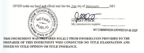
IN WITNESS WHEREOF, Grantor has caused this quitclaim to be signed on its behalf by its Mayor and attested by its Clerk-Treasurer, this the 23rd day of February
STATE OF ALABAMA) COUNTY OF MADISON)
I, the undersigned, a Notary Pub- lic in and for said County, in said State, hereby certify that Tommy Battle and Kenneth Benion, whose names as Mayor and City Clerk-Treasurer, respectively, of the CITY OF HUNTSVILLE, ALABAMA, a municipal corporation are signed to the foregoing instrument, and who are known to me, acknowledged before me on this day that, being info1med of the contents of the instrument, they, as such officers and with full authority, executed the same for and as the act of said municipal corporation.
Pursuant to and in accordance with Section 40-22-1 of the Code of Alabama (1975), the following infonnation is offered in lieu of submitting Fom1 RT-I:
Grantor’s Address:
308 Fountain Circle, P.O. Box 308, Huntsville, Alabama 35801 Grantee’s Address:
120 N. Hale Street, Suite 300, Wheaton, Illinois 60187 Property Address: N/A Purchase Price: N/A
APPROVED this the 23rd day of February, 2023.
Exhibit “A”
Legal Description of Right-of-Way
A PARCEL OF LAND SITUATED IN NORTHWEST QUARTER OF SECTION 1, TOWNSHIP 4 SOUTH, RANGE 1 WEST, MADISON COUNTY, ALABAMA, AND BEING MORE PARTICULARLY DESCRIBED AS FOLLOWS:
COMMENCING AT A FOUND 1/2- INCH IRON PIN ON THE NORTH MARGIN OF PELHAM A VENUE, SAID POINT BEING LOCATED SOUTH 1560.0 FEET AD WEST 982.0 FEET FROM THE CENTER OF THE NORTH BOUNDARY OF SECTION 1, TOWNSHIP 4 SOUTH, RANGE 1 WEST THENCE RUNNING NORTH I DEGREES 27 MINUTES WEST ALONG THE WESTERLY BOUNDARY OF COUNCIL COURTS PROJECT
NO. 47-1, A DISTANCE OF 99.75 FEET; THENCE LEAVING SAID COUNCIL COURTS BOUNDARY AND RUNNING SOUTH 81 DEGREES 58 MINUTES 18 SECONDS WEST 158.69 FEET TO A POINT ON THE NORTHERLY MARGIN OF THE NEW LOCATION OF DA VJS AVENUE, SAID POINT BEING THE POINT OF CURVATURE OF A CURVE TO THE LEFT HAVING A RADIUS OF 427.55 FEET, A DELTA OF 54 DEGREES 55 MINUTES 12 SECONDS, AND A CHORD BEARING OF NORTH 69 DEGREES 34 MINUTES 22 SECONDS WEST AND CHORD DISTANCE OF 394.31 FEET; THENCE, RUN ALONG THE ARC OF SAID CURVE A DISTANCE OF 409.82 FEET TO A POINT ON THE NORTHERLY MARGIN OF THE NEW LOCATION OF DAVIS AVENUE; THENCE CONTINUING ALONG THE NORTHER- LY MARGIN OF DAVIS AVENUE SOUTH 82 DEGREES 58 MINUTES 03 SECONDS WEST 291.13 FEET TO A POINT, SAID POINT BEING THE POINT OF CURVATURE OF A CURVE TO THE RIGHT HAVING A RADIUS OF 100.00 FEET, A DELTA OF 33 DEGREES 33 MINUTES 20 SECONDS, AND A CHORD BEARING OF SOUTH 80 DEGREES 15 MINUTES 1 7 SECONDS EAST AND CHORD DISTANCE OF 57.73 FEET; THENCE, RUN ALONG THE ARC OF SAID CURVE A DISTANCE OF 58.57 FEET TO A POINT ON THE NORTHERLY M.tR.GIN OF THE NEW LOCATION OF DA VIS A VENUE; SAID POINT BEING THE POINT OF CURVATURE OF A CURVE TO THE LEFT HA YING A RADIUS OF 50.00 FEET, A DELTA OF 81 DEGREES 23 MINUTES 10 SECONDS, AND A CHORD BEARlNG OF SOUTH 75 DEGREES 49 MINUTES 56 SECONDS WEST AND CHORD DISTANCE or 65.20 FEET; THENCE, RUN ALONG THE ARC OF SAID CURVE A DISTANCE OF 71.02 FEET TO A POINT ON THE NORTHERLY MARGIN OF A CUL-DE-SAC AT THE WESTERLY END OF DA VIS A VENUE; THENCE LEA YING THE NORTHERLY MARGIN OF SAID CUL-DE-SAC AND RUNNING SOUTH 06 DEGREES 15 MINUTES 59 SECONDS EAST 66.13 FEET TO THE SOUTHERLY MARGIN OF SAID CUL-DE-SAC AND A 5/8” IRON PIN (SCHOEL CA#003), SAID POINT BEING THE POINT OF BEGINNING;
FROM THE POINT OF BEGINNING; SAID POINT BEING THE POINT OF CUR.V ATURE OF A CURVE TO THE LEFT HAVING A RADIUS OF 49.98 FEET, A DELTA OF 82 DEGREES 56 MINUTES 57 SECONDS, AND A CHORD BEARING OF SOUTH 89 DEGREES 07 MINUTES 30 SECONDS EAST AND CHORD DISTANCE OF 66.21 FEET; THENCE, RN ALONG THE ARC OF SAID CURVE A DISTANCE OF 72.36 FEET TO A 5/8” IRON PIN (SCHOEL CA#003) ON THE EXISTING SOUTHERN RIGHT- OF-WAY OF DAVIS CIRCLE SW; THENCE, SAID PIN MARKING
THE POINT OF CURVATURE OF A CURVE TO THE RIGHT HAVING A RADIUS OF 100.00 FEET, A DELTA OF 33 DEGREES l 1 MINUTES
23 SECONDS, AND A CHORD BEARING OF NORTH 66 DEGREES 00 MINUTES 24 SECONDS EAST AND CHORD DISTANCE OF 57 .12 FEET; THENCE, RUN ALONG THE ARC OF SAID CURVE. DISTANCE OF 57.93 FEET TO A 5/8” IRON PIN (SCHOEL CA#003) ON THE EXISTING SOUTHERN RIGHT- OF-WAY OF DAVIS CIRCLE SW; THENCE, LEAV1NG THE RIGHT- OF-WAY, SOUTH 82 DEGREES 47 MINUTES 04 SECONDS WEST FOR 86.51 FEET TO A POINT,
SAID POJNT BEING THE POINT OF CURVATURE Of A CURVE TO THE RIGHT HAVING A RADIUS
OF 525.00 FEET, A DELTA OF
03 DEGREES 05 MINUTES
04 SECONDS, AND A CHORD BEARING OF SOUTH 83 DEGREES 28 MINUTES 32 SECONDS WEST AND CHORD DISTANCE OF 28.26 FEET; THENCE, RUN ALONG THE ARC OF SAID CURVE A DISTANCE OF 28.26 FEET TO A POINT; THENCE, SOUTH 28 DEGREES
50 MINUTES 33 SECONDS WEST FOR 9.29 FEET TO RETURN TO THE POINT OF BEGINNING.
SAID PARCEL CONTAINS 0.04 ACRES (1,618 SQUARE FEET), MORE OR LESS.
1975, of all the property or territory hereinafter particularly described (which property or territory is hereinafter referred to as “the Property”), filed with the City Clerk-Treasurer of the City of Huntsville, Alabama, a signed and written petition requesting that the Property be annexed to the City of Huntsville, Alabama, which petition is on file with the City Clerk-Treasurer of the City of Huntsville, Alabama; and
WHEREAS, said petition contained the signatures of the owners of the Property, and filed together with said petition was a map showing the relationship of the Property to the corporate limits of the City of Huntsville, Alabama, which map is attached hereto and incorporated herein by reference; and
WHEREAS, the Property is contiguous to the present city limits of the City of Huntsville, Alabama, and the Property does not lie within the corporate limits or police jurisdiction of any other municipality; and
WHEREAS, the City Council of the City of Huntsville, Ala- bama, has determined that it is necessary and proper and in the public interest that the Property be brought within the corporate limits of the City of Huntsville, Alabama, and has further de- termined that all legal require- ments for annexing the Property have been met pursuant to Sections 11-42-20 through 11-42- 24, Code of Alabama 1975.
NOW, THEREFORE, BE IT OR- DAINED by the City Council of the City of Huntsville, Alabama, as follows:
1.That the City Council of the City of Huntsville, Alabama hereby


