
RESOLUTION NO. 23-77
WHEREAS, certain property has recently been annexed to the City of Huntsville, Alabama; and
WHEREAS, said property is now legally part of the incorporated municipality of the City of Huntsville, Alabama, and as such is subject to the laws and ordinances governing the City of Huntsville, Alabama; and
WHEREAS, said property, having been outside the boundaries of the City of Huntsville, Alabama, prior to the annexing of same to the City of Huntsville, Alabama, has never been subject to the Zoning Ordinances of the City of Huntsville, Alabama; and
WHEREAS, the Planning Commission of the City of Huntsville, Alabama, has given consideration to an amendment to the Zoning Ordinance, a synopsis of said amendment being as follows:
(1) The zoning of 3.47 acres of land lying on the north side of Winchester Rd and east of Bradford Ln. to Highway Business C-4 District.
2) The first publication of this resolution, this synopsis, and the ordinance hereinafter set out at length shall be in the Speakin’ Out News on the 22nd day of February, 2023, and the second publication shall be one week thereafter on the 1st day of March, 2023, both of which publications shall be at least 15 days in advance of the date of the public hearing hereinafter referred to.
WHEREAS, it is the judgement and opinion of the City Council of the City of Huntsville, Alabama, that consideration should be given to the adoption of an amendment to the Zoning Ordinance of the City of Huntsville, Alabama, in accordance with said request;
NOW, THEREFORE, BE IT RESOLVED by the City Council of the City of Huntsville, Alabama, as follows:
1. That the City Council of the City of Huntsville, Alabama, shall meet at 5:30p.m. on the 23rd day of March, 2023, in the Council Chambers of the City of Huntsville Administration Building at 308 Fountain Circle in the City of Huntsville, Alabama, for the purpose of holding a public hearing at which time and place all persons, parties in interest and cities who desire, shall have an opportunity to be heard in opposition to or in favor of said Ordinance No. 23-78, which is introduced by the City Council of the City of Huntsville on the 9th day of February, 2023, amending the Zoning Ordinance of the City of Huntsville, Alabama.
2. That the proposed amendment to the Zoning Ordinance of the City of Huntsville, Alabama, is substantially in words and figures as follows:
ORDINANCE NO. 23-78
AN ORDINANCE TO AMEND THE ZONING ORDINANCES OF THE CITY OF HUNTSVILLE, ALABAMA
The public welfare requiring it, and under authority granted by Section 11-52-78 of the 1975 Code of Alabama, BE IT ORDAINED by the City Council for the City of Huntsville, Alabama, as follows:
1. That the following area, land lying on the north side of Winchester Rd and east of Bradford Ln., which area is a newly annexed area of the City of Huntsville, Madison County, Alabama, and which has not been zoned previously, shall be shown and classified on the Official Zoning Maps of the City of Huntsville, Alabama, as Highway Business C-4 District, in the Zoning Ordinances of the City of Huntsville, Alabama, said property being particularly described as follows:
All that part of Sections 34 and 35, Township 2 South, Range 1 east of the Huntsville Meridian, in the City of Huntsville, Madison County, Alabama, more particularly described as beginning at a point located at the Southeast corner of said Section 34; thence North 4 Degrees 53 Minutes 34 Seconds West 174.00 feet to a point; said point is further described as the Point of True Beginning; thence North 1 Degrees 3 Minutes 54 Seconds East 698.39 feet to a point; thence South 89 Degrees 6 Minutes 10 Seconds East 231.37 feet to a point; thence South 0 Degrees 11 Minutes 39 Seconds West 434.41 feet to a point; thence South 1 Degrees 50 Minutes 30 Seconds East 140.17 feet to a point; thence South 63 Degrees 26 Minutes 6 Seconds West 69.88 feet to a point; thence South 64 Degrees 5 Minutes 37 Seconds West 101.33 feet to a point; thence South 64 Degrees 30 Minutes 43 Seconds West 103.79 feet to the Point of True Beginning and containing 3.47 acres more or less.
2. The boundaries of the above district as described and defined above are hereby established and shall be shown on the Official Zoning Maps of the City of Huntsville, Alabama, on file in the Planning Division of the Urban Development Department, in accordance with the various classifications herein enumerated and hereafter the regulations governing said district under the Zoning Ordinance of the City of Huntsville, Alabama, shall apply to the area so described.
3. This ordinance shall take effect from and after the date of publication.
ORDINANCE NO. 23-78 (Cont.)
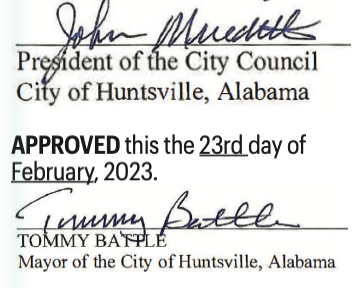
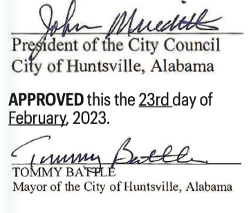
ADOPTED this the 9th day of February 2023.

APPROVED this the 9th day of February, 2023.

RESOLUTION NO. 23-77 (Cont.)
ADOPTED this the 9th day of February, 2023.
/s/ John Meredith
President of the City Council of the City of Huntsville, Alabama
APPROVED this the 9th day of February, 2023.
/s/ Tommy Battle
Mayor of the City of Huntsville, Alabama
——————————————————————————
RESOLUTION NO. 23-04
BE IT RESOLVED by the City Council of the City of Huntsville, within the State of Alabama, as follows:
1. That the Rocket City I, LLC, is the sole landowner abutting the property hereinafter described, made application for the vacation of a portion of that certain Right-of- Way more particularly described as follows (the “Right-of-Way” or the “Property”):
See Exhibit “A” attached hereto and incorporated herein.
2. That notice of the vacation of the Right-of-Way has been given as required by Section 23-4-1 et seq. of the Code of Alabama, 1975, as amended, and a public hearing held for purposes of allowing public comments on the proposed vacation before the City Council.
3. That after vacation of the designated portion of Right-of-Way and all public rights therein, convenient and reasonable means of ingress and egress to and from the respective property will be afforded to all property owners owning property in or near the Right-of-Way by the remaining streets, avenues, and highways.
4. That in the judgment and opinion of the City Council of the City of Huntsville that it is in the public interest and necessary and expedient that the City vacate the designated portion of Right-of-Way and that the vacation of the designated portion of Right-of-Way is in the best interests of the citizens of the City in that same will contribute to the health and general welfare of the citizens of the City of Huntsville, Alabama.
5. That the filing of the resolution with the Judge of Probate of Madison County, Alabama, shall operate as a declaration of the City’s vacation of that portion of the Right-of-Way as described herein and shall divest all public rights and liabilities, including any rights which may have been acquired by prescription, in that part of the Right-of-Way. Title and all public rights shall vest in the abutting landowner, Rocket City I, LLC.
6. That notice of this resolution shall be published in Speakin’ Out News no later than fourteen (14) days from the date hereof.
NOW THEREFORE, be it resolved by the City Council of the City of Huntsville that they do hereby assent to the said vacation of
the herein described portion of Right-of-Way and that the above de- scribed Property be and the same is hereby vacated and annulled and all public rights therein divested of the Property, with the City of Huntsville retaining a public utility and drainage Easements over, across and under subject property.
RESOLUTION NO. 23-04 (Cont.) ADOPTED this the 23rd day of February 2023.

APPROVED this the 23rd day of February, 2023.

EXHIBIT A
Right-of-way Vacation
STATE OF ALABAMA MADISON COUNTY
A PARCEL OF LAND SITUATED IN NORTHWEST QUARTER OF SECTION 1, TOWNSHIP 4 SOUTH, RANGE 1 WEST, MADISON COUNTY, ALABAMA, AND BEING MORE PARTICULARLY DESCRIBED AS FOLLOWS:
COMMENCING AT A FOUND 1⁄2-INCH IRON PIN ON THE NORTH MARGIN OF PELHAM A VENUE, SAID POINT BEING LOCATED SOUTH 1560.0 FEET AND WEST 982.0 FEET FROM THE CENTER OF THE NORTH BOUNDARY OF SECTION 1, TOWNSHIP 4 SOUTH, RANGE 1 WEST THENCE RUNNING NORTH 1 DEGREES 27 MINUTES WEST ALONG THE WESTERLY BOUND- ARY OF COUNCIL COURTS PROJECT NO. 47-1, A DISTANCE OF 99.75 FEET; THENCE LEAV- ING SAID COUNCIL COURTS BOUNDARY AND RUNNING SOUTH 81 DEGREES 58 MINUTES 18 SECONDS WEST 158.69 FEET TO A POINT ON THE NORTHERLY MARGIN OF THE NEW LOCATION OF DAVIS AVENUE, SAID POINT BEING THE POINT OF CURVA- TURE OF A CURVE TO THE LEFT HAVING A RADIUS OF 427.55 FEET, A DELTA OF 54 DEGREES 55 MINUTES 12 SECONDS, AND A CHORD BEARING OF NORTH 69 DEGREES 34 MINUTES 22 SECONDS WEST AND CHORD DISTANCE OF 394.31 FEET; THENCE, RUN ALONG THE ARCOF SAID CURVE A DISTANCE OF 409.82 FEET TO A POINT ON THE NORTHERLY MARGIN OF THE NEW LOCATION OF DA VIS A VENUE; THENCE CONTINUING ALONG THE NORTHERLY MAR- GIN OF DA VIS AVENUE SOUTH 82 DEGREES 58 MINUTES 03 SECONDS WEST 291.13 FEET TO A POINT, SAID POINT BEING THE POINT OF CURVATURE OF A CURVE TO THE RIGHT HA YING A RADIUS OF 100.00 FEET, A DEL- TA OF 33 DEGREES 33 MINUTES 20 SECONDS, AND A CHORD BEARING OF SOUTH 80 DEGREES 15 MINUTES 17 SECONDS EAST AND CHORD DISTANCE OF 57.73 FEET; THENCE, RUN ALONG THE ARC OF SAID CURVE A DISTANCE OF 58.57 FEET TO A POINT ON THE NORTHERLY MARGIN OF THE NEW LOCATION OF DA VIS A VENUE; SAID POINT BEING THE POINT OF CURVATURE OF A CURVE TO THE LEFT HA YING A RADIUS OF 50.00 FEET, A DELTA OF 81 DEGREES 23 MINUTES 10 SECONDS, AND A CHORD BEARING OF SOUTH 75 DEGREES 49 MINUTES 56 SECONDS WEST AND CHORD DISTANCE OF 65.20 FEET; THENCE, RUN ALONG THE ARC OF SAID CURVE A DISTANCE OF 71.02 FEET TO A POINT ON THE NORTHERLY MARGIN OF A CUL- DE-SAC AT THE WESTERLY END OF DA VIS A VENUE; THENCE LEA VINO THE NORTHERLY MARGIN OF SAID CUL-DE-SAC AND RUNNING SOUTH 06 DEGREES 15 MINUTES 59 SECONDS EAST 66.13 FEET TO THE SOUTHERLY MARGIN OF SAID CUL-DE-SAC AND A 5/8” IRON PIN (SCHOEL CA #003), SAID POINT BEING THE POINT OF BEGINNING;FROM THE POINT OF BEGIN- NING; SAID POINT BEING THE POINT OF CURVATURE OF A CURVE TO THE LEFT HAVING A RADIUS OF 49.98 FEET, A DELTA OF 82 DEGREES 56 MINUTES 57 SECONDS, AND A CHORD BEARING OF SOUTH 89 DEGREES 07 MINUTES 30 SECONDS EAST AND CHORD DISTANCE OF 66.21 FEET; THENCE, RUN ALONG THE ARC OF SAID CURVE A DISTANCE OF 72.36 FEET TO A 5/8” IRON PIN (SCHOEL CA#003), SAID POINT BEING THE POINT OF BEGINNING;
FROM THE POINT OF BEGINNING; SAID POINT BEING THE POINT OF CURVATURE OF A CURVE TO THE LEFT HAVING A RADIUS OF 49.98 FEET, A DELTA OF 82 DEGREES 56 MINUTES 57 SECONDS, AND A CHORD BEARING OF SOUTH 89 DEGREES 07 MINUTES 30 SECONDS EAST AND CHORD DISTANCE OF 66.21 FEET; THENCE, RUN ALONG THE ARC OF SAID CURVE A DISTANCE OF 72.36 FEET TO A 5/8” IRON PIN (SCHOEL CA#003) ON THE EXISTING SOUTHERN RIGHT-OF-WAY OF DAVIS CIRCLE SW; THENCE, SAID PIN MARKING THE POINT OF CURVATURE OF A CURVE TO THE RIGHT HAVING A RADIUS OF 100.00 FEET, A DELTA OF 33 DEGREES 11 MINUTES 23 SECONDS, AND A CHORD BEARING OF NORTH 66 DEGREES 00 MINUTES 24 SECONDS EAST AND CHORD DISTANCE OF 57.12 FEET; THENCE, RUN ALONG THE ARC OF SAID CURVE A DISTANCE OF 57.93 FEET TO A 5/8” IRON PIN (SCHOEL CA#003) ON THE EXISTING SOUTHERN RIGHT- OF-WAY OF DAVIS CIRCLE SW; THENCE, LEAVING THE RIGHT- OF-WAY, SOUTH 82 DEGREES 47 MINUTES 04 SECONDS WEST FOR 86.51 FEET TO A POINT, SAID POINT BEING THE POINT OF CURVATURE OF A CURVE TO THE RIGHT HAVING A RADIUS OF 525.00 FEET, A DELTA OF 03 DEGREES 05 MINUTES 04 SECONDS, AND A CHORD BEARING OF SOUTH 83 DEGREES 28 MINUTES 32 SECONDS WEST AND CHORD DISTANCE OF 28.26 FEET; THENCE, RUN ALONG THE ARC OF SAID CURVE A DISTANCE OF 28.26 FEET TO A POINT; THENCE, SOUTH 28 DEGREES 50 MINUTES 33 SECONDS WEST FOR 9.29 FEET TO RETURN TO THE POINT OF BEGINNING.
SAID PARCEL CONTAINS 0.04 ACRES (1,618 SQUARE FEET), MORE OR LESS.
—————————————————————————————————-
ORDINANCE NO. 23-05
BE IT ORDAINED by the City Council of the City of Huntsville, Alabama, as follows:
Section 1. The City Council of the City of Huntsville, Alabama, finds that an application has been presented to the City of Huntsville requesting the vacation of a right-of-way; that the applicants have represented to the City of Huntsville that Rocket City I, LLC, is the owner of the property across which said right-of-way lies; that said right-of-way, or the portion being vacated, is not presently used and is no longer needed for a public or municipal purpose.
Section 2. Pursuant to the findings in Section 1 hcrcinabovc, the Mayor of the City of Huntsville, Alabama, is hereby authorized, requested and directed to execute a quitclaim deed vacating the right-of-way hereinafter described, said deed being substantially in words and figures as follows, to-wit:
THIS INSTRUMENT PREPARED BY: Samuel H. Givhan
WILMER & LEE, P.A.
100 Washington Street,
STATE OF ALABAMA (COUNTY OF MADISON)
QUIT CLAIM DEED FOR VACATION OF RIGHT OF WAY
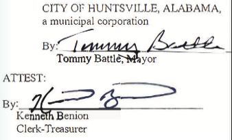
THIS INDENTURE made and entered into on this 23rd day of February, 2023 by and between, CITY OF HUNTSVILLE, ALABAMA, an Alabama municipal corporation (“Grantor”) and Rocket City I, LLC, a Delaware limited liability company (“Grantee”).
WITNESSETH: That the Grantor, for and in consideration of Ten Dollars ($10.00) in hand paid by Grantee , and other good and valuable consideration, the receipt and sufficiency whereof is hereby acknowledged,, does hereby remise, release, quitclaim, and convey unto the Grantee, all of the Grantor’s right, title, interest and claim in and to the following described real estate situated in the City of Huntsville, County of Madison, State of Alabama, to-wit:
See Exhibit “A.” attached hereto.
Said right-of-way to be vacated as depicted on Exhibit “B” attached hereto.
TO HAVE AND TO HOLD unto the said Grantee, its successors and assigns forever.
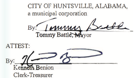
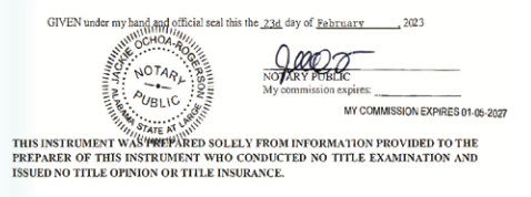
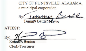
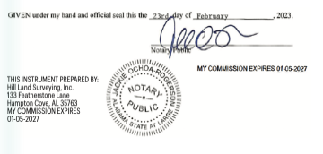
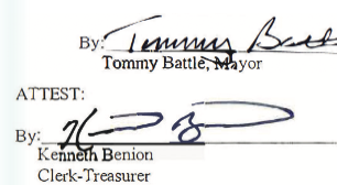
IN WITNESS WHEREOF, Grantor has caused this quitclaim to be signed on its behalf by its Mayor and attested by its Clerk-Treasurer, this the 23rd day of February
STATE OF ALABAMA (COUNTY OF MADISON)
I, the undersigned, a Notary Public in and for said County, in said State, hereby certify that Tommy Battle and Kenneth Benion, whose names as Mayor and City Clerk-Treasurer, respectively, of the CITY OF HUNTSVILLE, ALABAMA, a municipal corporation are signed to the foregoing instrument, and who are known to me, acknowledged before me on this day that, being info1med of the contents of the instrument, they, as such officers and with full authority, executed the same for and as the act of said municipal corporation.
Pursuant to and in accordance with Section 40-22-1 of the Code of Alabama (1975), the following information is offered in lieu of submitting Form1 RT-I:
Grantor’s Address: 308 Fountain Circle, P.O. Box 308, Huntsville, Alabama 35801
Grantee’s Address: 120 N. Hale Street, Suite 300, Wheaton, Illinois 60187 Property Address: N/A Purchase Price: N/A
APPROVED this the 23rd day of February, 2023.
Exhibit “A”
Legal Description of Right-of-Way
A PARCEL OF LAND SITUATED IN NORTHWEST QUARTER OF SECTION 1, TOWNSHIP 4 SOUTH, RANGE 1 WEST, MADISON COUNTY, ALABAMA, AND BEING MORE PARTICULARLY DESCRIBED AS FOLLOWS:
COMMENCING AT A FOUND 1/2- INCH IRON PIN ON THE NORTH MARGIN OF PELHAM A VENUE, SAID POINT BEING LOCATED SOUTH 1560.0 FEET AD WEST 982.0 FEET FROM THE CENTER OF THE NORTH BOUNDARY OF SECTION 1, TOWNSHIP 4 SOUTH, RANGE 1 WEST THENCE RUNNING NORTH I DEGREES 27 MINUTES WEST ALONG THE WESTERLY BOUNDARY OF COUNCIL COURTS PROJECT
NO. 47-1, A DISTANCE OF 99.75 FEET; THENCE LEAVING SAID COUNCIL COURTS BOUNDARY AND RUNNING SOUTH 81 DEGREES 58 MINUTES 18 SECONDS WEST 158.69 FEET TO A POINT ON THE NORTHERLY MARGIN OF THE NEW LOCATION OF DA VJS AVENUE, SAID POINT BEING THE POINT OF CURVATURE OF A CURVE TO THE LEFT HAVING A RADIUS OF 427.55 FEET, A DELTA OF 54 DEGREES 55 MINUTES 12 SECONDS, AND A CHORD BEARING OF NORTH 69 DEGREES 34 MINUTES 22 SECONDS WEST AND CHORD DISTANCE OF 394.31 FEET; THENCE, RUN ALONG THE ARC OF SAID CURVE A DISTANCE OF 409.82 FEET TO A POINT ON THE NORTHERLY MARGIN OF THE NEW LOCATION OF DAVIS AVENUE; THENCE CONTINUING ALONG THE NORTHER- LY MARGIN OF DAVIS AVENUE SOUTH 82 DEGREES 58 MINUTES 03 SECONDS WEST 291.13 FEET TO A POINT, SAID POINT BEING THE POINT OF CURVATURE OF A CURVE TO THE RIGHT HAVING A RADIUS OF 100.00 FEET, A DELTA OF 33 DEGREES 33 MINUTES 20 SECONDS, AND A CHORD BEARING OF SOUTH 80 DEGREES 15 MINUTES 1 7 SECONDS EAST AND CHORD DISTANCE OF 57.73 FEET; THENCE, RUN ALONG THE ARC OF SAID CURVE A DISTANCE OF 58.57 FEET TO A POINT ON THE NORTHERLY M.tR.GIN OF THE NEW LOCATION OF DA VIS A VENUE; SAID POINT BEING THE POINT OF CURVATURE OF A CURVE TO THE LEFT HA YING A RADIUS OF 50.00 FEET, A DELTA OF 81 DEGREES 23 MINUTES 10 SECONDS, AND A CHORD BEARlNG OF SOUTH 75 DEGREES 49 MINUTES 56 SECONDS WEST AND CHORD DISTANCE or 65.20 FEET; THENCE, RUN ALONG THE ARC OF SAID CURVE A DISTANCE OF 71.02 FEET TO A POINT ON THE NORTHERLY MARGIN OF A CUL-DE-SAC AT THE WESTERLY END OF DA VIS A VENUE; THENCE LEA YING THE NORTHERLY MARGIN OF SAID CUL-DE-SAC AND RUNNING SOUTH 06 DEGREES 15 MINUTES 59 SECONDS EAST 66.13 FEET TO THE SOUTHERLY MARGIN OF SAID CUL-DE-SAC AND A 5/8” IRON PIN (SCHOEL CA#003), SAID POINT BEING THE POINT OF BEGINNING;
FROM THE POINT OF BEGINNING; SAID POINT BEING THE POINT OF CUR.V ATURE OF A CURVE TO THE LEFT HAVING A RADIUS OF 49.98 FEET, A DELTA OF 82 DEGREES 56 MINUTES 57 SECONDS, AND A CHORD BEARING OF SOUTH 89 DEGREES 07 MINUTES 30 SECONDS EAST AND CHORD DISTANCE OF 66.21 FEET; THENCE, RN ALONG THE ARC OF SAID CURVE A DISTANCE OF 72.36 FEET TO A 5/8” IRON PIN (SCHOEL CA#003) ON THE EXISTING SOUTHERN RIGHT- OF-WAY OF DAVIS CIRCLE SW; THENCE, SAID PIN MARKING THE POINT OF CURVATURE OF A CURVE TO THE RIGHT HAVING A RADIUS OF 100.00 FEET, A DELTA OF 33 DEGREES l 1 MINUTES23 SECONDS, AND A CHORD BEARING OF NORTH 66 DEGREES 00 MINUTES 24 SECONDS EAST AND CHORD DISTANCE OF 57 .12 FEET; THENCE, RUN ALONG THE ARC OF SAID CURVE. DISTANCE OF 57.93 FEET TO A 5/8” IRON PIN (SCHOEL CA#003) ON THE EXISTING SOUTHERN RIGHT- OF-WAY OF DAVIS CIRCLE SW; THENCE, LEAV1NG THE RIGHT- OF-WAY, SOUTH 82 DEGREES 47 MINUTES 04 SECONDS WEST FOR 86.51 FEET TO A POINT, SAID POJNT BEING THE POINT OF CURVATURE Of A CURVE TO THE RIGHT HAVING A RADIUS OF 525.00 FEET, A DELTA OF03 DEGREES 05 MINUTES 04 SECONDS, AND A CHORD BEARING OF SOUTH 83 DEGREES 28 MINUTES 32 SECONDS WEST AND CHORD DISTANCE OF 28.26 FEET; THENCE, RUN ALONG THE ARC OF SAID CURVE A DISTANCE OF 28.26 FEET TO A POINT; THENCE, SOUTH 28 DEGREES 50 MINUTES 33 SECONDS WEST FOR 9.29 FEET TO RETURN TO THE POINT OF BEGINNING.
SAID PARCEL CONTAINS 0.04 ACRES (1,618 SQUARE FEET), MORE OR LESS.
Ordinance No. 23-05 (Cont.)
ADOPTED this the 23rd day of February 2023.

APPROVED this the 23rd day of February, 2023.

ORDINANCE NO. 23-110
WHEREAS, William Louis Vaughn, Jr. and Patricia C. Vaughn, being the owners, as the term is defined by Section 11-42-20, Code of Alabama
TO: The City Clerk-Treasurer of the City of Huntsville, Alabama, and the City Council of the City of Huntsville, Alabama
FROM: William Louis Vaughn, Jr. and Patricia C. Vaughn (hereinafter referred to as “the petitioners”)
A. The Petitioners do hereby sign and file with the City Clerk-Treasurer of the City of Huntsville, Alabama, this written petition requesting that the real property or territory hereinafter described, which real property or territory is hereinafter referred to as “the Property”, be annexed to the
City of Huntsville, Alabama, under the authority of and pursuant to Sections 11-42-20 through 11-42-24 of the Code of Alabama 1975; and in support there- of do hereby certify as follows:
1. That the Petitioners are the owners of the Property, as the term “owner” is defined by Section 11-42-20, Code of Alabama 1975.
2. That the Property is situated in Madison County, Alabama, and is accurately described on the attached Exhibit “A”, which exhibit is incorporated herein by reference.
3. That the Petitioners have the right and authority to make and file this petition for annexation.
4. That the Property is contiguous to the existing corporate limits of the City of Huntsville, Alabama.
5. That the Property does not lie within the corporate limits or police jurisdiction of any other municipality.
6. That the Petitioners have attached hereto as Exhibit “B”, which exhibit is incorporated herein by reference, and filed herewith a map of the Property showing its relationship to the corporate limits of the City of Huntsville, Alabama, which said map is further identified as being entitled “Vaughn Property to be Annexed.”
B. This petition may be signed in any number of counterparts, each of which shall be deemed an original, and all of which taken together shall constitute one and the same petition.
THE FOREGOING CONSIDERED, we, the Petitioners hereby petition and request that the City Council of the City of Huntsville, Alabama, adopt an ordinance assenting to the annexation of the Property to the City of Huntsville, Alabama, all in accordance with the statutes herein provided.
IN WITNESS WHEREOF, we, the undersigned Petitioners have hereunto subscribed om names as of the 23rd day of January.
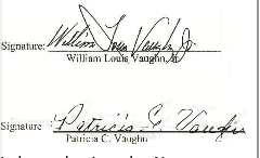
I, the undersigned, a Notary Public in and for said County in said State; hereby certify that William Louis Vaughn, Jr., whose name is signed to the foregoing annexation petition and who are known to me, acknowledged before me on this date that, being informed of the contents of said petition, be executed the same voluntarily as of the day the same bears date.
Given under my hand and official seal of office, this the 23rd day of January 2023
I, the undersigned. a Notary Public in and for said County in said State, hereby certify that Patricia C. Vaughn, whose name is signed to the foregoing annexation petition and who are known to me, acknowledged before me on this date that, being informed of the contents of said petition, she executed the same voluntarily as of the day the same bears date.
Given under my hand and official seal of office, this the 23rd day of January 2023
EXHIBIT “A”
(Legal Description of the Property) All that part of Section 21, Township 3 South, Range 2 West of the Huntsville Meridian, Madison County, Alabama more particularly described as beginning at a point located at the southwest corner of said Section 21; thence North 31 Degrees 10 Minutes 19 Seconds East 2,645.06 feet to a point; said point is further described as the Point of True Beginning; thence North O Degrees 55 Minutes IO Seconds West 357.19 feet to a point; thence South 88 Degrees 36 Minutes 10 Seconds East 35.6 feet to a point; thence North 7 Degrees 7 Minutes 30 Seconds East 7 .00 feet to a point; thence North 89 Degrees 39 Minutes 17 Seconds East J 44.10 feet to a point; thence North 88 Degrees 59 Minutes 42 Seconds East 49.49 feet to a point; thence South 6 Degrees 26 Minutes 41 Seconds East 241.65 feet to a point; thence South 28 Degrees 3 8 Minutes 1 Seconds West 149 .23 feet to a point; thence North 88 Degrees 20 Minutes O Seconds West 133.57 feet to a point;
thence North 88 Degrees 20 Minutes O Seconds West 46.4 feet to a point; thence North I Degrees 14 Minutes 37 Seconds West 0.91 feet to the Point of True Beginning and contain ing 1.96 acres more or less.
ANNEXATION SUMMARY: VAUGHN January 18, 2023
PETITIONER: William Louis Vaughn, Jr. and Patricia C. Vaughn
LOCATION: On the east of Wall Triana Blvd. and south of McCrary Rd., Township 3 South, Range 2, Section 21, 448 McCrary Rd., Madison, AL 35757
ACREAGE: 1.96 acres
REASON FOR REQUEST:
City Services
ANNEXATION GUIDELINES: Vaughn
I. Annexations that would fill in or make more regular the existing corporate limits should be strong- ly encouraged.
WOULD CONTINUE ONGOING ANNEXATIONS IN THIS AREA
2. The remaining tax islands should be annexed when owner- ship changes and redevelopment occurs ….
NOT A TAX ISLAND
3. Annexations of land in subdivisions ….
NOT PART OF A SUBDIVISION
4. Corridors are discouraged ….
NOT A CORRIDOR
5. Point-to-point annexations should be discouraged ….
NOT A POINT-TO-POINT CONNECTION
6. Owners living on land expect ed to be annexed within the ninety-day period preceding a municipal election .
NO MUNICIPAL EL ECTION AT TIME OF ANNEXATION
7. Land which is known to be contaminated should not be annexed until such danger has been mitigated.
NO KNOWN CONTAMINATION
8. The annexation of land that would contribute to the city’s economic development through an increase in taxes ….
RESIDENTIAL LAND
9. The city should require petitions for annexation referenda to satisfy additional
conditions ….
NOT A REFERENDA
10. City planners will explain to all annexation petitioners the policies under which services are provided.
POLICY STATEMENT SIGNED BY OWNERS; COPY ATTACHED STATEMENT REGARDING PROVISION OF CITY SERVICES TO NEWLY ANNEXED LANDS
City services will be provided to all newly annexed lands according to the same policies that already govern in Huntsville. This means that Huntsville police and fire departments will respond to cans; garbage and trash will be collected by city sanitation; and school children will attend city rather than county schools. Transportation for students attending the city schools will be the responsibility of their parents. AU applicable city ordinances will be enforced including the implementation of zoning regulations. Please note that the National agency that established the rating schedule for fire insurance premiums (ISO) assigns a higher rate to property that is over 5 road miles from their responding fire station and/or over 1000 feet from a fire hydrant.
Water service is provided by Huntsville Utilities; however if the annexed land is already served by another water authority, the existing situation should be expected to continue until such time as development pressure or legal agreements between water authorities makes it feasible or possible for Huntsville Utilities to assume control of the water lines or extend new mains. The cost of main extensions usually are borne by the property owner.
Likewise, it has long been city policy to expand sanitary sewer service on a cost benefit basis. This policy applies to all land within the city regardless of its annexation date. In addition, the city has adopted a capital improvement plan to guide investment in infrastructure. In order for an area to be considered for road construction, drainage improvements, recreational or community facilities, new fire stations, or sanitary sewer extension, the area must be in the city and then must be prioritized according to need. Newly annexed land will be accorded the same consideration as other city lands.
Lastly, it is important to understand that those autonomous boards, agencies and utilities that have authority over the delivery of specific public services set their own policies and procedures.
I have read the above statement governing the delivery of city services to lands annexed into the city of Huntsville, and 1 agree to these conditions as they may pertain to any of my lands that are annexed.

——————————————————————————
ORDINANCENO.23-111
Ordinance to Declare Property as Surplus and Authorizing and Directing its Conveyance
WHEREAS, the City of Huntsville, an Alabama municipal corporation (“City”), is the owner of certain vacant parcel of real property situated in Huntsville, Limestone County, Alabama, contain- ing 1.39 acres, more or less, located to the east of Greenbrier Parkway, and as more particularly described in Exhibit “A” attached hereto (the “Subject Property”); and
WHEREAS, RaceTrac, Inc., a Georgia corporation, has proposed to convey to the City a parcel of real property situated in Huntsville, Limestone County, Alabama, containing 1.42 acres, more or less, located off of the east side of Greenbrier Parkway, and as more particularly described in Exhibit “B” attached hereto (the “Race Trac Property”), which the City desires to acquire for the construction, establish, and maintenance of a new public right-of-way and related public infra- structure, in exchange for the Subject Property; and
WHEREAS, RaceTrac, Inc. has request- ed that the City declare the Subject Property as surplus and offer the same for conveyance to RaceTrac, Inc. in exchange for the RaceTrac Property; and
WHEREAS, it is the opinion of the Mayor and the City Council of the City of Huntsville, Alabama, that, pursuant to §11-47-20 of the Alabama Code (1975), that the Subject Property is no longer used or needed for municipal purposes; and
WHEREAS, in the opinion of the Mayor and the City Council of City of Huntsville, that Subject Property and RaceTrac Property are of equivalent monetary value, and that the City’s receipt of the Race Trac Property in exchange for its conveyance of the Subject Property to RaceTrac, Inc. is fair and reasonable compensation for the Subject Property; and
WHEREAS, the Mayor of the City of Huntsville is hereby authorized to enter into that certain Property Exchange Agreement between the City of Huntsville and Race Trac, Inc., attached here- to as Exhibit “C” (the “Agreement”), pursuant to the terms and conditions contained therein, the Subject Property will be transferred by the City to the RaceTrac, Inc., in exchange for Race Trac, Inc. ‘s transfer of the Race Trac Property to the City, and subject to those conditions contained therein and as prescribed by and in accordance with § 31-4-1 et seq of the Alabama Code (1975); and
WHEREAS, in the opinion of the Mayor and the City Council of the City of Huntsville, Alabama, the RaceTrac Property is fair and reasonable compensation for the Subject Property, and that conveyance of the Subject Property to Race Trac, Inc. in exchange for the Race Trac Property for the construction, establishment, use, operation, and maintenance by the City for a new public right-of-way and related public infrastructure, benefits the citizens of Huntsville; and
ORDINANCE NO. 23- 111 (Cont.)
WHEREAS, a general and permanent ordinance is necessary to effect declaration of surplus property, for the transfer, sale, or exchange of said surplus property, and to authorize the Mayor to execute a statutory warranty deed to the grantee of surplus property.
NOW, THEREFORE, BE IT ORDAINED BY THE CITY COUNCIL OF THE CITY OF HUNTSVILLE, ALABAMA, AS FOLLOWS:
1. The Subject Property is found and determined not to be needed for public or municipal purposes by the City of Huntsville and is hereby declared as surplus property in accordance with the requirements of § 11-47-20 of the Alabama Code (1975); and
2. The Mayor of the City of Huntsville is hereby authorized and directed to execute the Agreement and to execute and deliver all documents required to close said exchange for and on behalf of the City; and
3. The City Clerk for the City of Huntsville is hereby instructed to publish notice of this Ordinance in accordance with § 11-45-8 of the Alabama Code (1975); and
4. A copy of said real estate closing documents, as legally required, will be kept on file in the office of the Clerk-Treasurer of the City of Huntsville Alabama; and
5. This ordinance shall become effective upon its approval, adoption, enactment, and publication by posting as set forth in § 11-45-8(b) of the Alabama Code (1975).
ADOPTED this the 23rd day of February, 2023.
President o the City Council of the City of Huntsville, Alabama
APPROVED this the 23rd day of February, 2023.
Mayor of the City of Huntsville, Alabama
EXHIBIT “A”
(Legal Description of Subject Property)
Begin at the northwest corner of Section 34, Township 4 South, Range 3 West, Huntsville, Limestone County, Alabama and run thence South 01 degrees 03 minutes 39 seconds West a distance of 1896.95 feet to a point; thence South 88 degrees 56 minutes 21 seconds
East a distance of 67.15 feet to a point; thence South 01 degrees 08 minutes 18 seconds West a distance of 860.30 feet to a point on the northwest corner of Lot 1, Racetrac-Greenbrier, as recorded by map or plat in the Limestone County, Alabama Probate Judge’s Office, in Map Book K, at Pages 234 and 235; thence South 89 degrees 15 minutes 26 seconds
East along the north boundary of said Lot 1 a distance of 620 .14 feet to a point; thence South O 1 degrees 08 minutes 18 seconds West along the east boundary of said Lot I a distance of 100.00 feet to the true point of beginning of the tract herein described; thence from the true point of beginning South 89 degrees 15 minutes 26 seconds
East a distance of 126.00 feet to a point; thence South 01 degrees 08 minutes 18 seconds West a distance of 479.25 feet to a point; thence North 89 degrees 15 minutes 26 seconds West a distance of 126.00 feet to the south- east corner of said Lot 1; thence North O I degrees 08 minutes 18 seconds
East along the east boundary of said Lot1 a distance of 479.25 feet to the true point of beginning, and containing 1.39 acres, more or less.
EXHIBIT “B” (Legal Description of the RacTrac Property)
Begin at the northwest corner of Section 34, Township 4 South, Range 3 West, Huntsville, Limestone County, Alabama and run thence South 01 degrees 03 minutes 39 seconds West a distance of 1896.95 feet to a point; thence South 88 degrees 56 minutes 21 seconds East a distance of 67.15 feet to a point; thence South 01 degrees 08 minutes 18 seconds West a distance of 860.30 feet to a point on the northwest comer of Lot 1, Racetrac-Greenbrier, as recorded by map or plat in the Limestone County, Alabama Probate Judge’s Office, in Map Book K, at Pages 234 and 235 and the true point of beginning of the tract herein described; thence from the true point of beginning South 89 degrees 15 minutes 26 seconds East along the north boundary of said Lot 1 a distance of 620.14 feet to a point; thence South 01 degrees 08 minutes 18 seconds West along the east boundary of said Lot 1
a distance of 100.00 feet to a point; thence North 89 degrees 15 minutes 26 seconds West a distance of 620.14 feet to the east right-of-way margin of Greenbrier Parkway
(ROW Varies); thence North 01 degrees 08 minutes 18 seconds East along the east right-of-way margin of Greenbrier Parkway a distance of 100.00 feet to the true point of beginning, and containing 1.42 acres, more or less.
EXHIBIT “C” (Property Exchange Agreement)
[Attach copy of Property Exchange Agreement between the City of Huntsville and Race Trac, Inc.]
PROPERTY EXCHANGE AGREEMENT
THIS PROPERTY EXCHANGE AGREEMENT (the “Agreement”) is made and entered into as of the 23rd day of February , 2023 (the “Effective Date”), by and between the RaceTrac, Inc., a Georgia corporation (“RaceTrac”), and City of Huntsville, an Alabama municipal corporation (the “City”).
WHEREAS, the City is the owner of that certain parcel of real property located in Huntsville, Limestone County, Alabama, consisting of approximately 1.39 acres, more or less, located to the east of Greenbrier Parkway, more particularly described in Exhibit “A” attached hereto, and depicted as Parcel 1 in that drawing attached as Exhibit “B” hereto (“Parcel l “).
WHEREAS, RaceTrac is the owner of that certain parcel of real property lo- cated in Huntsville, Limestone County, Alabama, consisting of approximately 1.42 acres, more or less, located off of the east side of Greenbrier Parkway, more particularly described in Exhibit “C” attached hereto, and depicted as Parcel 2 in that drawing attached as Exhibit “D” hereto (“Parcel 2”).
WHEREAS, RaceTrac desires to transfer and convey Parcel 2 to the City in exchange for Parcel 1, and the City desires to transfer and convey Parcel 1 to RaceTrac in exchange for
Parcel 2.
WHEREAS, the parties have agreed to exchange or swap Parcel l and Parcel 2 with one another pursuant to the terms and conditions set forth herein.
NOW THEREFORE, in consideration of the matters described above, and of the promises and the mutual covenants contained therein, the parties hereby agree as follows:
1. Exchange of Parcel 1 and Parcel 2. At “Closing” ( as defined in Section 4 below), the City agrees to transfer and convey Parcel 1 to RaceTrac in exchange for Parcel 2, and RaceTrac agrees to transfer and convey Parcel 2 to the City in exchange for Parcel 1 (the “Exchange”). Together, Parcel 1 and Parcel 2 shall be referred to collectively as the “Exchange Property.”
2. Consideration. For purposes of this Agreement, the parties agree that the value of Parcel 2 is equal to the value of Parcel 1. Accordingly, except as otherwise set forth herein, there shall be no additional consideration paid by Race Trac to the City or any additional consideration paid by the City to Race Trac for or in connection with the Exchange.
3. Deeds. It is understood and agreed that the title to Parcel 1 required to
be furnished at Closing is fee simple marketable title of record, free and clear of all encumbrances except for (i) ad valorem taxes for the current year, (ii) all easements, restrictions, rights- of-way, or other matters of record, and (iii) any matters that would be reflected by a current accurate survey (the “Permitted Exceptions”). Parcel 1 shall be conveyed by statutory warranty deed, free and clear of any and all liens, except for the Permitted Exceptions (the “City Deed”). It is understood and agreed that title to Parcel 2 required to be furnished at Closing is fee simple marketable title of record, free and clear of all encumbrances except for the Pennitted Exceptions. Parcel 2 shall be conveyed by statutory warranty deed, free and clear of any and all liens, except for the Permitted Exceptions (the “RaceTrac Deed”). Together, the City Deed and the RaceTrac Deed shall be collectively referred to as the ‘’Exchange Deeds.”
4. Closing. The Exchange Deeds shall be delivered and the Exchange shall occur (“Closing”) at the law offices of Wilmer & Lee, P.A., located at 100 Washington Street, Huntsville, Alabama 35801 (“Closing Agent’’). Closing shall occur on or within sixty (60) days following the satisfaction of the Closing Conditions (defined in Section 7 be- low), or at such earlier date and time as is mutually agreed upon by the parties (“Closing Date”). The parties may deliver any documents or consideration as required herein to the Closing Agent on or before the Closing Date, such that neither party shall be required to be physically present at Closing.
5. Possession. Possession of the Exchange Property shall be delivered by each party to the other party at Closing.
6. Title Commitments: Surveys. The City, at its own expense, may obtain from the Closing Agent (i) a commitment to issue an ALTA owner’s policy of title insurance with respect to Parcel 2 (“Parcel 2 Commitment”), and (ii) may obtain an ALTA survey of Parcel 2 to be prepared by a reputable registered public land surveyor licensed by the State of Alabama (“Parcel 2 Survey”). RaceTrac, at its own expense, may obtain from the Closing Agent (i) a commitment to issue an ALTA owner’s policy of title insurance on Parcel 1 and (“City Title Commitment”), and (ii) may obtain an AL TA survey of Parcel 1 to be prepared by a reputable registered public land surveyor licensed by the State of Alabama (“Parcel 1 Survey”).
7. Closing Conditions. Closing and the parties obligation to convey the Exchange Property is contingent upon the following conditions being satisfied prior to Closing:
(a) Declaration of Surplus. Declaration of Parcel l as “surplus” and approval of a surplus ordinance by the City Council of the City of Huntsville.
(b) Approval bv Cit.v Council. Approval of this Agreement by the City Council of the City of Huntsville.
8. Taxes. Ad valorem taxes on the Exchange Property shall be prorated as of the Closing Date, such that RaceTrac will be responsible for any taxes due on Parcel 2 up to the Closing Date and the City will be responsible for the taxes on Parcel 2 after the Closing Date; and the City will be responsible for any taxes due on Parcel 1 up to the Closing Date and RaceTrac will be responsible for the taxes on Parcel 1 after the Closing Date.
9. Inspection of Exchange Property. The “Inspection Period” shall be the period of sixty (60) days from the Effective Date. During the Inspection Period, the parties shall each have the right and privilege of entering upon Parcel 1 (in the case of Race Trac) and Parcel 2 (in the case of the City) with its agents, employees, contractors, engineers and such other representatives as are needed to inspect, examine, survey and otherwise conduct such activity which the entering party deems necessary or desirable in determining the suitability of the Exchange Property for the party’s intended use thereof. Each party is responsible for any costs or expenses associated with its own inspection and examination of the Exchange Property.
10. Closing Costs and Closing Documents. At Closing, the City shall pay for the cost to prepare the City Deed, and RaceTrac shall pay for all deed or transfer taxes, recording fees, and other closing costs associated with Parcel 1. RaceTrac shall pay for the cost to prepare the Race Trac Deed, and the City shall pay for all deed or transfer taxes, recording fees, or other closing costs associated with Parcel 2. Any title insurance premium for Parcel 2 shall be paid by the City.
Any title insurance premium, for Parcel I shall be paid by RaceTrac. Each party shall pay its own attorney’s fees and all due diligence costs incurred by such party in connection with this Agreement. The Closing Agent shall prepare all closing documents and will send the same to the City and RaceTrac for review in sufficient time prior to Closing. Such closing documents shall include without limitation the Exchange Deeds, an exchange statement, owners’ affidavits, FIRPTA, Form 1099-B, and any other closing document or other instruments, as may be necessary or is reasonably requested by the Closing Agent to consummate the Exchange contemplated by this Agreement.
11. Permitting and Approvals: Final Subdivision Plat. Racetrac, its agents, employees, contractors, and assigns will use commercially reasonable efforts to obtain all necessary licenses, permits, and certificates that are required to construct, operate, and maintain Parcel I. Accordingly, the
City shall work in good faith to assist RaceTrac in its application for all applicable permits, licenses, or approvals required in connection with RaceTrac’s intended use of Parcel 1. However, RaceTrac acknowledges and agrees that the City is in no way waiving or disclaiming, nor should this provision be construed as a waiver of, any applicable City licensing, permitting, design, or building requirements, rules, or regulations. Additionally, the parties shall work in good faith with one another to have Parcel 1 resubdivided and/ or combined with RaceTrac’s adjacent property and platted in accordance with the City’s subdivision regulations (the “Plat”). Specifically, RaceTrac understands and agrees that no grading permit or building permit can be issued by the City until the Plat has been finalized, approved and recorded in the Probate Records of Limestone County, Alabama, as required by the City’s subdivision regulations and permitting requirements.
12. Assignment. Neither party may assign this Agreement in whole or in part without the prior written consent of the other party, which consent may be withheld in such party’s sole and absolute discretion.
13. Authority. RaceTrac represents and warrants, to and for the benefit of the City, that Race Trac has the authority to convey Parcel 2 in accordance with the terms of this Agreement and the indi- vidual(s) signing this Agreement and all documents executed or to be executed by RaceTrac are and shall be duly authorized to sign on behalf of RaceTrac. The City represents and warrants, to and for the benefit of RaceTrac, that, subject to the conditions described in Sections 7(a) and 7(b) above, the City has the authority to convey Parcel 1 in accordance with the terms of this Agreement and the individual(s) signing this Agreement and all documents executed or to be executed by the City are and shall be duly authorized to sign on behalf of the City.
14. Broker’s Fees. The parties represent that there are no brokers fees or real estate commissions due on account of their actions. Each party agrees to indemnify, defend and hold the other harmless from any claims of real estate agents or brokers claiming through the party. The parties agree to indemnify and hold one another harmless from and against any and all loss, cost, damage, claim ,. and expense, including attorney’s fees, incurred by or assessed against the other as a result of a breach of the foregoing covenants and representations made by each of them.
15. Attorney’s Fees. In the event either party initiates any lawsuit, litigation, or legal action regarding the terms of this Agreement or the Exchange Property described herein, the prevailing party shall be entitled to collect reasonable attorney’s fees and court costs, as allowed by the laws of the State of Alabama.
16. Construction of Agreement. The terms and conditions of this Agreement shall be construed, interpreted and enforced in accordance with the laws of the State of Alabama, without regard to its conflict of law provisions.
17. Entire Agreement. This Agreement contains the entire agreement between the parties with respect to the transactions provided for herein, and the parties hereto agree that no other representations have been relied on by either party.
18. Successors and Assinns. This Agreement shall be binding upon the successors and assigns of the parties, and inure to benefit of the successors and assigns of both parties.
19. Notice. All notices shall be in writing and may be delivered by any of the following methods: (i) hand delivery, (ii) Certified United States Mail or other nationally recognized overnight deliv- ery service (such as UPS or FedEx), or (iii) electronic transmission, including email or pdf transmission. Such notices shall be deemed received, (i) if delivered by hand, on the date of delivery, (ii) if sent by U.S. Mail or overnight delivery service, on the date the same is deposited with the applicable carrier, or (iii) if delivered by email or pdf trans- mission on the date the transmission is sent. Notices shall be addressed to the party to which notice is to be given as set forth below:
To: RaceTrac: RaceTrac, Inc.
Attn: Sr. Real Estate Counsel
200 Galleria Parkway SE, Suite 900 Atlanta, Georgia 30339
With a copy to: RaceTrac, Inc.
Attn: Sr. Real Estate Counsel
200 Galleria Parkway SE, Suite 900 Atlanta, Georgia 30339
Phone:
Email:
With a copy to: Attn:
Phone:
Email:
To: City of Huntsville
Attn: Shane Davis & Jim McGuffey 320 Fountain Circle
Huntsville, Alabama 35801
Phone: 256-427-5100
Email: shane.davis@huntsvilleal.gov Jim.mcuffey@huntsvilleal.gov
With a copy to: Wilmer and Lee, P.A. Attn: Samuel H. Givhan & Katie Beasley 100 Washington Street
Huntsville, Alabama 35801
Phone: 256-533-0202
Email: sgivhan@wilmerlee.com kbeasley@wilmerlee.com
20. Survival. Any terms and covenants contained in this Agreement which require the performance of either party after the Closing shall survive Closing and delivery of the Exchange Deeds.
21. Effective Date. The Effective Date shall mean the date this agreement bas been executed by the City.
22. Execution bv Counterpart Originals. This Agreement may be executed in one or more counterparts, each of which shall be deemed an original, but all of which together shall constitute one and the same instrument.
23. Email. Facsimile. or Electronic Signatures. This Agreement may be executed and the signatures transmitted by facsimile, email, or other electronic transmission. Documents executed, scanned, and transmitted electronically, and electronic signatures shall be deemed original signatures for purposes of this Agreement and all matters related thereto, with such scanned and/or electronic signatures having the same legal effect as original signatures.
Notwithstanding the foregoing, the parties agree that they will transmit their original signature pages to the Closing Agent promptly after execution. Furthermore, RaceTrac understands and acknowledges that the City must receive Race Trac’ s original signature page before this Agreement will be placed on the next available agenda for consideration by the City Council of the City of Huntsville.
24. Counsel Acknowledgment. The parties all acknowledge that the City’s counsel, SAMUEL H. GIVHAN and KATHERINE AMOS BEASLEY, and the law firm of Wihner & Lee, P.A. (collectively “Counsel”) prepared this Agreement on behalf of and in the course of its representation of the City and, for the purposes of this transaction; Counsel represents the City’s interest and no other interests. All conflicts of interest due to Counsel’s representation of the City are hereby waived.
25. Cooperation; Further Assurances. The parties hereto agree to cooperate with one another and will work in good faith and will use their reasonable best efforts in order to complete each of their respective obligations and to complete the transaction contemplated herein. Additionally, the parties, at the Closing Agents request, shall exe- cute and delivery any additional documents reasonably required to carry out the transaction contemplated by this Agreement or to correct any scrivener’s error or omissions contained in this Agreement or any document executed pursuant hereto or in connection with the transaction contemplated herein.
26. Post-Closing Obligations. As a material inducement to cause the parties to enter into this Agreement, the parties agree to perform certain obligations after Closing (the “Post- Closing Obligations”):
(a) The City, at its expense, shall construct and install a full 4 leg signalized intersection at the proposed entrance of Parcel 2 with Greenbrier Parkway. This will include the relocation of an existing power pole located within the right-of-way near the current proposed entrance to Parcel 2 and relocating any other existing utilities necessary to construct the signalized intersection. RaceTrac, at its expense, shall hire an engineer to prepare the signal design plans to be used by the City.
(b) RaceTrac shall construct the Access Road located on Parcel 2 in accordance to the City’s asphalt paving specifications. Once construction is completed, RaceTrac shall dedicate the Access Road to the City, and the City will accept the dedication thereof, and agrees to maintain the Access Road.
( c) All three connection points from Parcel 1 to the Access Road on Parcel 2 shall be full access driveways as more particularly described and depicted on Exhibit “E” attached hereto and incorporated herein and shall remain full access even if the City modifies the access road in the future, so long as said full access does not create a public safety issue for the general public.
( d) The stormwater drainage on Parcel 2 for the Access Drive shall be collect- ed and discharged to the right-of-way of Parcel 1 and shall be separate from any stormwater/detention requirement for Parcel 1.The provisions of this Section shall survive Closing and shall not merge with the deed. Those obligations set forth above are Post-Closing Obligations and accordingly, shall be satisfied and/or performed after Closing, and in accordance with the terms and conditions contained herein.
IN WITNESS WHEREOF, the parties have caused this Agreement to be executed on the date first written above.
(Signatures and acknowledgments)
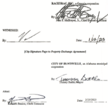
Exhibit “A”
(Description of Parcel 1 – City to RaceTrac)
Begin at the northwest corner of Section 34, Township 4 South, Range 3 West, Huntsville, Limestone County, Alabama and run thence South 01 degrees 03 minutes 39 seconds West a distance of 1896.95 feet to a point; thence South 88 degrees 56 minutes 21 seconds East a distance of 67.15 feet to a point; thence South 01 degrees 08 minutes 18 seconds West a distance of 860.30 feet to a point on the northwest corner of Lot 1, Racetrac-Greenbrier, as recorded by map or plat in the Limestone County, Alabama Probate Judge’s Office, in Map Book K, at Pages 234 and 235; thence South 89 degrees 15 minutes 26 seconds East along the north boundary of said Lot 1 a distance of 620 .14 feet to a point; thence South 01 degrees 08 minutes 18 seconds West along the east boundary of said Lot 1 a distance of 100.00 feet to the true point of beginning of the tract herein described; thence from the true point of beginning South 89 degrees 15 minutes 26 seconds East a distance of 126.00 feet to a point; thence South 01 degrees 08 minutes 18 seconds West a distance of 479.25 feet to a point; thence North 89 degrees 15 minutes 26 seconds West a distance of 126.00 feet to the southeast corner of said Lot 1; thence North 01 degrees 08 minutes 18 seconds East along the east boundary of said Lot 1 a distance of 479.25 feet to the true point of beginning, and containing 1.39 acres, more or less.
Exhibit “C”
(Legal Description of Parcel 2 – Race Trac to City)
Begin at the northwest corner of Section 34, Township 4 South, Range 3 West, Huntsville, Limestone County, Alabama and run thence South 01 degrees 03 minutes 39 seconds West a distance of 1896.95 feet to a point; thence South 88 degrees 56 minutes 21 seconds East a distance of 67.15 feet to a point; thence South 01 degrees 08 minutes 18 seconds West a distance of 860.30 feet to a point on the northwest comer of Lot 1, Racetrac-Greenbrier, as recorded by map or plat in the Limestone County, Alabama Probate Judge’s Office, in Map Book K, at Pages 234 and 235 and the true point beginning of the tract herein described; thence from the true point of beginning South 89 degrees 15 minutes 26 seconds East along the north boundary of said Lot 1 a distance of 620 .14 feet to a point; thence South O 1 degrees 08 minutes 18 seconds West along the east boundary of said Lot 1 a distance of 100.00 feet to a point; thence North 89 degrees 15 minutes 26 seconds West a distance of 620.14 feet to the east right-of-way margin of Greenbrier Parkway (ROW Varies); thence North 01 degrees 08 minutes 18 seconds East along the east right-of-way margin of Greenbrier Parkway a distance of 100.00 feet to the true point of beginning, and containing 1.42 acres, more or less.
WHEREAS, Ordinance No. 75-243 provides for the publication of a notice that such application has been made and setting a date for a public hearing.
NOW, THEREFORE, BE IT RESOLVED by the City Council of the City of Huntsville, Alabama, as follows:
- That the intent of the City Council of the City of Huntsville, Alabama to consider whether a public convenience and necessity justifies the issuance of a taxi license to Terry James d/b/a Express Taxi and Shuttle LLC for the operation of three (3) taxicabs is hereby declared.
- That the City Council of the City of Huntsville shall meet at 5:30 P.M. on the 9th day of March, 2023, at the Council Hall or at such other place announced by the Council in the City of Huntsville for the purpose of holding a public hearing on the question of whether public convenience and necessity justifies the issuance of a taxi license to Terry James d/b/a Express Taxi and Shuttle LLC the operation of three (3) taxicabs, at which time all parties may appear in person, by agent, or by attorney for the purpose of voicing objections or remonstrations.
- That this resolution shall be published in the Huntsville Times, a newspaper of general circulation within the City of Huntsville, Alabama, said publication to be not less than seven days prior to the date of this hearing.
ADOPTED this the 23rd day of February, 2023.
/s/ John Meredith
President of the City Council of
the City of Huntsville, Alabama
APPROVED this the 23rd day of February, 2023.
/s/ Tommy Battle
Mayor of the City of Huntsville,
Alabama
——————————————————————————————————–
ORDINANCE NO. 23-121
BE IT ORDAINED by the City Council of the City of Huntsville, Alabama, as follows:
Section 1. The City Council of the City of Huntsville, Alabama, finds that an application has been presented to the City of Huntsville requesting the vacation of a utility and drainage easement; that the applicant has represent- ed to the City of Huntsville that Acclaim Solutions, LLC, is the owner of the property across which said easement lies; that said easement, or the portion being vacated, is not presently used and is no longer needed for a public or municipal purpose.
Section 2. Pursuant to the findings in Section 1 herein- above, the Mayor of the City of Huntsville, Alabama, is hereby authorized, requested, and directed to execute a quitclaim deed vacating the easement hereinafter described, said deed being substantially in words and figures as follows, to-wit:
This Instnmient prepared by: J. Jameson Hughston
Black & Hughston, P.C., 406 W. Avalon Ave.Muscle Shoals, AL 35661 (256) 383-5707
The following information is offered in lieu of submitting an RT-1 Real Estate Sales Validation Form pursuant to Section 40-22-1 of the Code of Alabama (1975):
Grantor’s Name/Mailing Address: City of Huntsville, Alabama 308 Fountain Circle, P.O. Box 308, Huntsville, Alabama 35801
Grantee’s Name/Mailing Address: Acclaim Solutions, L, 265 Cox Creek Parkway South Florence, AL 35630
Property address: n/ a
Date of sale: February _, 2023 Purchase price: n/ a
The purchase price or actual value claimed in this instrument can be verified in the following documentary evidence:
_ Bill of Sale _ Sales Contract
_ Closing Statement _ Appraisal _ Other
QUITCLAIM DEED FOR QUITCLAIM DEED FOR VACATION OF EASEMENT
WHEREAS, the City of Huntsville Alabama (the “Grantor”) is the holder of a utility and drainage easement as shown in Plat Book K, Pages 267-268, recorded in the Office of the Judge of Probate of Limestone County, and more particularly described on Exhibit A attached hereto (the “Easement Property”); and
WHEREAS, the Grantor has agreed to vacate the Easement Property and to convey all of its right, title and interest in and to the Easement Property to Acclaim Solutions, LLC, an Alabama limited liability company (the “Grantee”).
NOW, THEREFORE, KNOW ALL PERSONS BY THESE PRESENTS, that the Grantor, for and in consideration of One Dollar ($1.00) and other good and valuable consideration, the receipt and legal sufficiency of which are hereby acknowledged, does hereby rernise, release, and forever quitclaim to the Grantee, all its right, title, interest and claim in and to the Easement Property.
Grantor attests, to the best of its knowledge and belief, that the information submitted in the legend at the beginning of this Deed in lieu of the RT-1 Real Estate Sales Validation Form is true and accurate, and Grantor under- stands that any false statements contained in such information may result in the imposition of the penalty indicated in Code of Alabama 1975 § 40-22-l(h).
TO HAVE AND TO HOLD the Easement Property unto the Grantee forever.
IN WITNESS WHEREOF, Grantor has caused this instrument to be executed on or as of the 23rd day of February , 2023.
STATE OF ALABAMA (COUNTY OF MADISON )
I, the undersigned, a notary public in and for said County, in said State, hereby certify that Tommy Battle and Ken Benion, whose names as Mayor and City Clerk Treasurer, respectively, of The City of Huntsville, Alabama, a municipal corporation are signed to the foregoing document, and who are known to me, acknowledged before me on this day that, being informed of the contents of the instrument, they, as such officers and with full authority, executed the same for and as the act of said corporation on the day the same bears day.
Given under my hand and official seal this the 23rd day of February 2023.
EXHIBIT A Property Description
STATE OF ALABAMA COUNTY OF LIMESTONE PORTION OF PUBLIC UTILITY AND DRAINAGE EASEMENT TO BEV ACATED
A tract of land lying in Lot 1, Devaney Farms North Lot 1 & Lot 2, as the same appears in the Office of the Judge of Probate in Limestone County, Alabama in Plat Book K, Pages 267 – 268: Commence at a CA451LS pin found on the Northeast corner of said Lot 1; thence North 89° 53’ 43” West, 10.00 feet to the POINT OF BEGINNING of the tract of land hereby described; thence South 00° 10’ 02” West, 271.74 feet to a point; thence South 55° 24’ 20” West, 83.09 feet to a point; thence North 89° 53’
37” West, 98.86 feet to a point; thence South 69° 44’ 12” West, 94.57 feet to a point; thence North 00° 10’ 02” East, 10.67 feet to a point; thence North 69° 44’ 12” East, 92.65 feet to a point; thence South 89° 53’ 37” East, 97.53 feet to a point; thence North 55° 24’ 20” East, 74.74 feet to a point; thence North 00° 10’ 02” East, 266.51 feet to a point; thence South 89° 49’ 58” East, 10.00 feet to the POINT OF BEGINNING of the tract of land hereby described; said tract of land contains 0.12 acres± and is subject to a 40’ ingress/ egress and utility easement (RLPY 2022, 81305 – 81307) off the Northside thereof and is subject to any and all easements or restrictions of record or unrecorded affecting said property.
Ordinance No. 23-121 (Cont.) ADOPTED this the 23rd day of February, 2023.
—————————————————————————
ORDINANCE NO. 23-122
BE IT ORDAINED by the City Council of the City of Huntsville, Alabama, as follows:
Section 1. The City Council of the City of Huntsville, Alabama, finds that an application has
been presented to the City of Huntsville requesting the vacation of a utility and drainage easement; that the applicant has represented to the City of Huntsville that Curtis Anderson, is the owner of the property across which said easement lies; that said easement, or the portion being vacated, is not presently used and is no longer needed for a public or municipal purpose.
Section 2. Pursuant to the findings in Section 1 here in above, the Mayor of the City of Huntsville, Alabama, is hereby authorized, requested and directed to execute a quitclaim deed vacating the easement hereinafter described, said deed being substantially in words and figures as follows, to-wit:
STATE OF ALABAMA ) COUNTY OF MADISON )
QUITCLAIM DEED
KNOW ALL MEN BY THESE PRESENTS, that the undersigned CITY OF HUNTSVILLE, an Alabama municipal corporation, herein- after referred to as Grantor, in consideration of the sum of Ten Dollars ($10.00) in hand paid by Curtis Anderson, a married man, hereinafter referred to as Grantee, and other good and valuable considerations, the receipt and sufficiency whereof is hereby acknowledged, does hereby remise, release, quitclaim, and convey unto the Grantee, all of the Grantor’s right, title, interest and claim in and to the following described real estate situated in the City of Huntsville, County of Madison, State of Alabama, to-wit:
ALL THAT PART OF LOT 51 OF MARINA PARK SUBDIVISION PHASE 1, AS RECORDED ON PLAT BOOK 47 ON PAGE 20 IN THE PROBATE RECORDS OF MADISON COUNTY, ALABAMA, MORE PARTICULARLY DESCRIBED AS COMMENCING AT A 5/8”, R. SMITH CAPPED REBAR FOUND AT THE NORTHEAST CORNER OF LOT 51 OF SAID SUBDIVISION; THENCE, ALONG THE BOUNDARY BETWEEN SAID LOT 51 AND LOT 50 OF SAID SUBDIVISION, S 53 ° 54’20” E 29.39’; THENCE, LEAVING SAID BOUNDARY, INTO SAID LOT 51, S 37 ° 56’04” W 6.18’ TO THE POINT OF BEGINNING OF THE TRACT HEREIN DESCRIBED.
THENCE, FROM THE POINT OF BEGINNING, S 52 ° 03’56” E 5.73’ TO THE SOUTHEASTERLY MARGIN OF 35’ PUBLIC UTILITY AND DRAINAGE EASMENT; THENCE, ALONG SAID MARGIN, ALONG A CURVE TO THE RIGHT WITH A RADIUS OF 2002.21’, THE CHORD BEARING AND DISTANCE BEING S 37 ° 17’13” W 24.00’; THENCE, LEAVING SAID MARGIN, INTO SAID EASEMENT, N 52 ° 03’56” W 6.00’; THENCE N 37 ° 56’04” E 24.00’ TO THE POINT OF BEGINNING, CONTAINING 141 SQUARE FEET, MORE OR LESS, ACCORDING TO A SURVEY BY HILL LAND SURVEYING, INC., DATED JANUARY 25, 2023.
TO HAVE AND TO HOLD unto the said grantee, its successors and assigns forever.
IN WITNESS WHEREOF, Grantor has caused this quitclaim to be signed in its behalf by its Mayor and attested by its Clerk-Treasurer, this the 23rd day of February, 2023.
STATE OF ALABAMA ) COUNTY OF MADISON)
I, the undersigned, a notary public in and for said County, in said State, hereby certify that Tommy Battle and Kenneth Benion, whose names as Mayor and City Clerk-Treasurer, respectively, of The City of Huntsville, Alabama, a municipal corporation are signed to the foregoing document, and who are known to me, acknowledged before me on this day that, being informed of the contents of the instrument, they, as such officers and with full authority, executed the same for and as the act of said corporation on the day the same bears day.
Ordinance No. 23-122 (Cont.)
ADOPTED this the 23rd day of February, 2023.
ORDINANCE NO. 23-123
BE IT ORDAINED by the City Council of the City of Huntsville, Alabama, as follows:
Section 1. The City Council of the City of Huntsville, Alabama, finds that an application has been presented to the City of Huntsville requesting the vacation of a utility and drainage easement; that the applicant has represented to the City of Huntsville that 5 Points Group, LLC,is the owner of the property across which said easement lies; that said easement, or the portion being vacated, is not presently used and is no longer needed for a public or municipal purpose.
Section 2. Pursuant to the findings in Section 1 hereinabove, the Mayor of the City of Huntsville, Alabama, is hereby authorized, requested and directed to execute a quitclaim deed vacating the easement hereinafter described, said deed being substantially in words and figures as follows, to-wit:
STATE OF ALABAMA (COUNTY OF MADISON )
QUITCLAIM DEED
KNOW ALL MEN BY THESE PRESENTS, That for and in consideration of the sum of One and 00/100 ($1.00) Dollar and other good and valuable considerations paid to CITY OF HUNTSVILLE, AN ALABAMA MUNICIPAL CORPORATION’ Grantor, in hand paid by 5 POINTS GROUP, LLC, AN ALABAMA LIMITED LIABILITY COMPANY, Grantee, the receipt of which is hereby acknowledged, the said Grantor hereby remises, releases, quitclaims and conveys unto the said Grantee, all of said Grantor’s right, title, interest and claim, in and to the following described real estate, situated in Madison County, Alabama, to-wit:
Vacate the easement as stated on Exhibit “A” attached hereto.
TO HAVE AND TO HOLD the same unto the said Grantee and Grantee’s successors and assigns of said Grantee forever
IN TESTIMONY WHEREOF, the Grantor has caused this instrument to be executed on the 23rd day of February, 2023.
CITY OF HUNTSVILLE, A MUNICIPAL CORPORATION IN THE STATE OF ALABAMA
STATE OF ALABAMA ( COUNTY Of MADISON )
‘I, the undersigned, a Notary Public in and for said County and State, do hereby certify that before me personally appeared TOMMY BATTLE AND KENNETH BENION, whose names as MAYOR AND CLERK-TREASURER, RESPECTIVELY, OF THE CITY OF HUNTSVILLE, ALABAMA, A MUNICIPAL CORPORATION, are signed to the foregoing Quit- claim Deed, and who are known to me, acknowledged before me on this day, that being informed of the contents of this conveyance, they, as such officers and with full authority, executed the same for and as the act of said Municipal corporation on the date the same bears date.

Grantor address: City of Huntsville 308 Fountain Circle, Huntsville, AL 35801
Grantee address is P. 0. Box 230817 Montgomery, AL 36123
Property address: 301 Pratt Avenue Huntsville, AL 35801 Value $100
Date of transfer: ____, 2023.
This Instrument Prepared By: A. Mac Martinson, Esq. Martinson & Beason, P.C. Attorneys at Law
115 North Side Square Huntsville, Alabama 35801 (256) 533-1667 File: 011305-01
STATE OF ALABAMA) COUNTY OF MADISON)
Exhibit “A”
EASEMENT VACATION:
The 5 foot utility and drainage easement on both the no rth side and south side of LOT A, according to the re-subdivision of LOTS 11, 12, and 13, in BLOCK 78, in East Huntsville Addition to the City of Huntsville, as recorded in the Office of the Judge of Probate of Madison County, Alabama, in Plat Book 34 Page 1; and
Ordinance No. 23-123 (Cont.) ADOPTED this the 23rd day of February, 2023.

APPROVED this the 23rd day of February, 2023.

——————————————————————————
ORDINANCE NO. 23-124
BE IT ORDAINED by the City Council of the City of Huntsville, Alabama, as follows:
Section 1. The City Council of the City of Huntsville, Alabama, finds that an application has been presented to the City of Huntsville requesting the vaca- tion of a portion of a utility and drainage easement; that the applicant has represented to the City of Huntsville that H2S, LLC Freeman Series, is the owner of the property across which said easement lies; that said easement, or the portion being vacated, is not presently used and is no longer needed for a public or municipal purpose.
Section 2. Pursuant to the findings in Section I herein- above, the Mayor of the City of Huntsville, Alabama, is hereby authorized, requested, and directed to execute a quitclaim deed vacating the easement hereinafter described, said deed being substantially in words and figures as follows, to-wit:
(Space Above Line for Use by Recording Office)
THIS INSTRUMENT PREPARED BY: Paul B. Seeley LANIER FORD SHAVER
& PAYNE P.C. 2101 West Clinton Ave., Ste. 102 Huntsville, Alabama 35805 (256) 535-1100
QUITCLAIM DEED FOR VACATION OF RIGHT OF WAY WITH EASEMENT RESERVATION
THIS INDENTURE made and entered into on this 23rd day of February, 2023 by and between, CITY OF HUNTSVILLE, an Alabama municipal corporation (“Grantor”), and H2S, LLC Freeman Series, an Separate Series of H2S, LLC, an Alabama Series limited liability company (“Grantee”).
WITNESSETH: That the Grantor, for and in consideration of Ten Dollars ($10.00) in hand paid by Grantee, and other good and valuable considerations, the receipt and sufficiency where- of is hereby acknowledged, does hereby remise, release, quitclaim, and convey unto the Grantee, all of the Grantor’s right, title, interest and claim in and to the following described real estate situated in the City of Huntsville, County of Madison, State of Alabama:
See Exhibit “A”, attached hereto TO HAVE AND TO HOLD unto the said Grantee, its successors and assigns forever.
Pursuant to and in accordance with Section 40-22-1 of the Code of Alabama (1975), the following information is offered in lieu of submitting Form RT-1:
Grantor’s Address: 308 Fountain Circle, PO Box 308, Huntsville, AL 35801
Grantee’s Address: 125 North Side Square, Ste. 200, Huntsville, AL 35801
Property Address: n/a
Tax Parcel Id No(s).: n/a Purchase Price: n/a
IN WITNESS WHEREOF, Grantor has caused this quitclaim deed to be signed on its behalf by its Mayor and attested by its
Clerk-Treasurer, this the 23rd day of February 2023
STATE OF ALABAMA (COUNTY OF MADISON)
I, the undersigned, a Notary Public in and for said County, in said State, hereby certify that Tommy Battle and Kenneth Benion, whose names as Mayor and City Clerk-Treasurer, respectively, of the CITY OF HUNTSVILLE, ALABAMA, a municipal corporation are signed to the foregoing instrument, and who are known to me, acknowledged before me on this day that, being informed of the contents of the instrument, they, as such officers and with full authority, executed the same for and as the act of said municipal corporation.
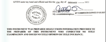
Exhibit “A”
RIGHT OF WAY VACATION PORTION OF 1 ST STREET
STATE OF ALABAMA COUNTY OF MADISON
ALL THAT PART OF THE SOUTH- EAST QUARTER OF SECTION 2, TOWNSHIP 4 SOUTH, RANGE
1 WEST OF THE HUNTSVILLE MERIDIAN, CITY OF HUNTSVILLE, MADISON COUNTY, ALABAMA, AND BEING MORE PARTICULARLY DESCRIBED AS FOLLOWS:
BEGINNING AT THE NORTHWEST CORNER OF LOT 7, BLOCK 1 OF SPRINGDALE FARMS AS RECORDED IN PLT A BOOK 1,PAGE 163 IN THE OFFICE OF THE JUDGE OF PROBATE, MADISON COUNTY, ALABAMA, AND HAVING ALABAMA STATE PLANE COORDINATES (EAST ZONE, NAO ‘83) OF NORTH: 1534175.84,EAST: 425723.52; SAID POINT OF BEGINNING LYING NORTH 88 DEGREES 03 MINUTES 39 SEC- ONDS WEST, 683.65 FEET FROM A 1/2- INCH IRON PIN (BENT) MARKING THE NORTHEAST COR- NER OF SAID LOT 7; SAID POINT OF BEGINNING BEING FURTHER DESCRIBED AS THE NORTHWEST CORNER OF THE FINAL PLAT OF FREEMAN ROAD TOWNHOMES AS RECORDED IN PLAT BOOK 2022, PAGE 317 IN SAID PROBATE OFFICE;
THENCE, FROM THE POINT OF BEGINNING, RUN ALONG SAID EAST MARGIN OF 1ST STREET, SOUTH 01 DEGREE 56 MINUTES 21 SECONDS WEST, 211.43 FEET TO A POINT LYING ON THE NORTH RIGHT-OF-WAY MARGIN OF FREEMAN ROAD (35 FOOT WIDE RIGHT-OF-WAY); THENCE, ALONG SAID NORTH MARGIN NORTH 88 DEGREES 03 MINUTES 39 SECONDS WEST, 35.00 FEET TO A POINT; THENCE NORTH 01 DEGREE 56 MINUTES 21 SECONDS EAST, 211.43 FEET TO A POINT; THENCE, ALONG THE SOUTH MARGIN OF THE ABANDONED TENTH AVENUE AND RAILROAD SPUR PROPERTY, SOUTH 88 DEGREES 03 MINUTES 39 SECONDS EAST, 35.00 FEET TO THE POINT OF BEGINNING AND CONTAINING 0.17 ACRES (7400 SQ. FT.) MORE OR LESS.
BUT RESERVING IN FAVOR OF THE CITY OF HUNTSVILLE A PUBLIC UTILITY AND DRAINAGE EASEMENT OVER, ACROSS AND UNDER THE REAL PROPERTY DESCRIBED AS FOLLOWS:
A 5 FOOT WIDE STRIP OF LAND EVENLY OFF OF THE WEST SIDE OF THE ABOVE DESCRIBED 0.17 ACRE PARCEL AND ALSO THE NORTH 100 FEET OF THE ABOVE DESCRIBED 0.17 ACRE PARCEL.
Ordinance No. 23-124 (Cont.) ADOPTED this the 23rd day of February, 2023.

APPROVED this the 23rd day of February, 2023.

—————————————————————————-
ORDINANCE NO. 23-125
BE IT ORDAINED by the City Council of the City of Huntsville, Alabama, as follows:
Section 1. The City Council of the City of Huntsville, Alabama, finds that an application has been presented to the City of Huntsville requesting the vacation of a utility and drainage easements; that the applicant has represented to the City of Huntsville that Huntsville Westside Apartments, LLC,
is the owner of the property across which said easements lie; that said easements, or the portions being vacated, are not presently used and are no longer needed for a public or municipal purpose.
Section 2. Pursuant to the findings in Section 1 herein- above, the Mayor of the City of Huntsville, Alabama, is hereby authorized, requested, and directed to execute a quitclaim deed vacating the easements hereinafter described, said deed being substantially in words and figures as follows, to-wit:
(Space Above Line for Use by Recording Office)
THIS INSTRUMENT PREPARED BY: W. Graham Burgess LANIER FORD SHAVER & PAYNE P.C.2101 West Clinton Ave., Ste. 102 Huntsville, Alabama 35805 (256) 535-1100
QUITCLAIM DEED
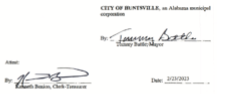
THIS QUITCLAIM DEED made and entered into on this 23rd day of February, 2023 by and between CITY OF HUNTSVILLE, an Alabama municipal company, (“Grantor”) and HUNTSVILLE WESTSIDE APARTMENTS, LLC, a Delaware limited liability company (“Grantee”).
WITNESSETH THAT FOR AND IN CONSIDERATION of the sum of Ten and Dollars ($10.00), cash and other good and valuable consideration, this day in hand paid to the Grantor by the Grantee, the receipt and sufficiency of alJ of which is hereby expressly acknowledged by the Grantor, the Grantor has this day remised, released, quitclaimed, conveyed and confirmed and does, by these presents, remise, release, quitclaim, convey and confirm, unto the Grantee, all of the Grantor’s right, title, interest and claim in and to the following described real estate situated in the City of Huntsville, County of Madison, State of Alabama, to wit:
SEE LEGAL DESCRIPTION ATTACHED HERETO AS EXHIBIT “A”, AND GRAPHICAL DEPICTION ATTACHED HERETO AS EXHIBIT “B” TO HAVE AND TO HOLD unto the said Grantee, its successors and assigns forever.
Pursuant to and in accordance with Section 40-22-1 of the Code of Alabama (1975), the following information is offered in lieu of submitting Form RT-I:
Grantor’s Address: 308 Fountain Circle, PO Box 308, Huntsville, Alabama 35801
Grantee’s Address: P.O. Box 242, Charleston, South Carolina 29401
Property Address: 3810 Governors Drive, Huntsville, Alabama 35805
Tax Parcel ID No. 17-02-03-2-003-012.000
Purchase Price: N/A
[ signature page to follow]
IN WITNESS WHEREOF, Grantor has caused this quitclaim to be signed on its behalf by its Mayor and attested by its Clerk-Treasurer, this the 23rd day of February,
(STATE OF ALABAMA COUNTY OF MADISON )
I, the undersigned, a Notary Public in and for the above County, in said State, hereby certify that Tommy Battle and Kenneth Benion, whose names as Mayor and City Clerk-Treasurer, respectively, of the CITY OF HUNTSVILLE, ALABAMA, a municipal corporation are signed to the foregoing conveyance and who are known to me, acknowledged before me on this day that, being informed of the contents of the conveyance, they, as such officers and with full authority, executed the same voluntarily for and as the act of said municipal corporation.
Given under my hand this the 23rd day of February, 2023.

THIS INFORMATION WAS PREPARED SOLELY FROM INFORMATION PROVIDED TO THE PREPARER OF THIS INSTRUMENT WHO CONDUCTED NO TITLE EXAMINATION AND ISSUED NO TITLE OPINION OR TITLE INSURANCE.
Exhibit “A”
Legal Description EASEMENT “A” – PUBLIC UTILITY & DRAINAGE EASEMENT TO BE VACATED
A PARCEL OF LAND SITUATED IN THE NORTHEAST QUARTER OF SECTION 3, TOWNSHIP 4 SOUTH, RANGE 1 WEST OF THE HUNTSVILLE MERIDIAN, MADISON COUNTY, ALABAMA AND LYING WITHIN LOT 2 OF THE BOUNDARY PLAT OF “THE FOUNDRY” AS RECORDED IN DOCUMENT NO. 2020-00096720 IN THE OFFICE OF THE JUDGE OF PROBATE, MADISON COUNTY, ALABAMA, AND BEING MORE PARTICULARLY DESCRIBED AS FOLLOWS:
COMMENCING AT A 5/8-INCH IRON PIN MARKING THE SOUTHEAST CORNER OF SAID LOT 2, AND HAVING ALABAMA STATE PLANE COORDINATES (EAST ZONE, NAO ‘83) OF NORTH: 1536352.30, EAST: 420929.09, AND BEING FURTHER DESCRIBED AS LYING ON THE NORTH RIGHT-OF-WAY MARGIN OF GOVERNORS DRIVE (R.O.W. WIDTH VARIES); THENCE NORTH 11 DEGREES 46 MINUTES 16 SECONDS WEST, 64.88 FEET TO THE POINT OF BEGINNING;
THENCE FROM THE POINT OF BEGINNING, NORTH 88 DEGREES 07 MINUTES 21 SECONDS WEST, 16.50 FEET TO A POINT; THENCE NORTH 01 DEGREE 52 MINUTES 39 SECONDS EAST, 26.20 FEET TO A POINT; THENCE SOUTH 88 DEGREES 07 MINUTES 21 SECONDS EAST, 16.50 FEET TO A POINT; THENCE SOUTH 01 DE- GREE 52 MINUTES 39 SECONDS WEST, 26.20 FEET BACK TO THE POINT OF BEGINNING AND CONTAINING 0.01 ACRES (432 SQUARE FEET) MORE OR LESS.
AND ALSO
EASEMENT “B” – PUBLIC UTILITY & DRAINAGE EASEMENT TO BE VACATED
A PARCEL OF LAND SITUATED IN THE NORTHEAST QUARTER OF SECTION 3, TOWNSHIP 4 SOUTH, RANGE 1 WEST OF THE HUNTSVILLE MERIDIAN, MADISON COUNTY, ALABAMA AND LYING WITHIN LOT 2 rn: THE BOUNDARY PLAT OF “THE FOUNDRY” AS RECORDED IN DOCUMENT NO. 2020-00096720 IN THE OFFICE OF THE JUDGE OF PROBATE, MADISON COUNTY, ALABAMA, AND BEING MORE PARTICULARLY DESCRIBED AS FOLLOWS:
COMMENCING AT A 5/8-INCH IRON PIN MARKING THE SOUTHEAST CORNER OF SAID LOT 2, AND HAVING ALABAMA STATE PLANE COORDINATES (EAST ZONE, NAO ‘83) OF NORTH: 1536352.30, EAST: 420929.09, AND BEING FURTHER DESCRIBED AS LYING ON THE NORTH RIGHT-OF-WAY MARGIN OF GOVERNORS DRIVE (R.O.W. WIDTH VARIES); THENCE NORTH 47 DEGREES 03 MINUTES 06 SECONDS WEST, 138.67 FEET TO THE POINT OF BEGINNING;
THENCE FROM THE POINT OF BEGINNING, NORTH 01 DEGREE 52 MINUTES 39 SECONDS EAST, 2.70 FEET TO A POINT; THENCE SOUTH 88 DEGREES 07 MINUTES 21 SECONDS EAST, 31.05 FEET TO A POINT; THENCE SOUTH 01 DE- GREE 51 MINUTES 44 SECONDS WEST, 2.70 FEET TO A POINT; THENCE NORTH 88 DEGREES 07 MINUTES 21 SECONDS WEST, 31.05 FEET BACK TO THE POINT OF BEGINNING AND CONTAINING 0.002 ACRES (84 SQUARE FEET) MORE OR LESS.
AND ALSO
EASEMENT “C” – PUBLIC UTILITY & DRAINAGE EASEMENT TO BE VACATED
A PARCEL OF LAND SITUATED IN THE NORTHEAST QUARTER OF SECTION 3, TOWNSHIP 4 SOUTH, RANGE 1 WEST OF THE HUNTSVILLE MERIDIAN, MADISON COUNTY, ALABAMA AND LYING WITHIN LOT 2 OF THE BOUND- ARY PLAT OF “THE FOUNDRY” AS RECORDED IN DOCUMENT NO. 2020-00096720 IN THE OFFICE OF THE JUDGE OF PROBATE, MADISON COUNTY, ALABAMA, AND BEING MORE PARTICULARLY DESCRIBED AS FOLLOWS:
COMMENCING AT A 1/2-INCH CAPPED IRON PIN (MCELROY) MARKING THE NORTHEAST CORNER OF SAID LOT 2, AND HAVING ALABAMA STATE PLANE COORDINATES (EAST ZONE, NAO ‘83) OF NORTH: 1537133.60, EAST: 420954.10, AND BEING FURTHER DESCRIBED AS LYING ON THE SOUTH RIGHT-OF-WAY MARGIN OF INTERSTATE 565 (R.O.W. WIDTH VARIES); THENCE SOUTH 27 DEGREES 11 MINUTES 42 SECONDS WEST, 171.34 FEET TO THE POINT OF BEGINNING;
THENCE FROM THE POINT OF BEGINNING, SOUTH 01 DEGREE 51 MINUTES 44 SECONDS WEST, 25.00 FEET TO A POINT; THENCE NORTH 88 DEGREES 08 MINUTES 16 SECONDS WEST, 4.00 FEET TO A POINT; THENCE NORTH 01 DE- GREE 51 MINUTES 44 SECONDS EAST, 25.00 FEET TO A POINT; THENCE SOUTH 88 DEGREES08 MINUTES 16 SECONDS EAST 4.00 FEET BACK TO THE POINT OF BEGINNING AND CONTAINING 0.002 ACRES (100 SQUARE FEET) MORE OR LESS.
AND ALSO:
EASEMENT “D” – PUBLIC UTILITY & DRAINAGE EASEMENT TO BE VACATED
A PARCEL OF LAND SITUATED IN THE NORTHEAST QUARTER OF SECTION 3, TOWNSHIP 4 SOUTH, RANGE 1 WEST OF THE HUNTS- VILLE MERIDIAN, MADISON COUNTY, ALABAMA AND LYING WITHIN LOT 2 OF THE BOUND- ARY PLAT OF “THE FOUNDRY” AS RECORDED IN DOCUMENT NO. 2020-00096720 IN THE OFFICE OF THE JUDGE OF PROBATE, MADISON COUNTY, ALABAMA, AND BEING MORE PARTICULARLY DESCRIBED AS FOLLOWS:
COMMENCING AT A 1/2-INCH CAPPED IRON PIN (MCELROY) MARKING THE NORTHEAST CORNER OF SAID LOT 2, AND HAVING ALABAMA STATE PLANE COORDINATES (EAST ZONE, NAD ‘83) OF NORTH: 1537133.60, EAST: 420954.10, AND BEING FURTHER DESCRIBED AS LYING ON THE SOUTH RIGHT-OF-WAY MARGIN OF INTERSTATE 565 (R.O.W. WIDTH VARIES); THENCE SOUTH 47 DEGREES 54 MINUTES 28 SECONDS WEST, 223.49 FEET TO THE POINT OF BEGINNING;
THENCE FROM THE POINT OF BEGINNING, SOUTH 49 DEGREE 31 MINUTES 09 SECONDS WEST, 7.66 FEET TO A POINT; THENCE NORTH 01 DEGREE 58 MINUTES 52 SECONDS EAST, 5.17 FEET TO A POINT; THENCE SOUTH 88 DEGREES 06 MINUTES 17 SECONDS EAST, 5.65 FEET BACK TO THE POINT OF BEGINNING AND CONTAINING 15 SQUARE FEET MORE OR LESS.
AND ALSO:
EASEMENT “E” – PUBLIC UTILITY & DRAINAGE EASEMENT TO BE VACATED
A-2 A PARCEL OF LAND SITUATED IN THE NORTH HALF OF SECTION 3, TOWNSHIP 4 SOUTH, RANGE 1 WEST OF THE HUNTSVILLE MERIDIAN, MADISON COUNTY,ALABAMA AND LYING WITH-IN LOT 2 OF THE BOUNDARY PLAT OF “THE FOUNDRY” AS RECORDED IN DOCUMENT NO. 2020-00096720 IN THE OFFICE OF THE JUDGE OF PROBATE, MADISON COUNTY, ALABAMA, AND BEING MORE PARTICULAR- LY DESCRIBED AS FOLLOWS: COMMENCING AT A 5/8-INCH CAPPED IRON PIN {SCHOEL CA#003) MARKING THE NORTH- EAST CORNER OF LOT 2 OF SAID BOUNDARY PLAT, AND HAVING ALABAMA STATE PLANE COOR- DINATES (EAST ZONE, NAD ‘83) OF NORTH: 1536745.57, EAST: 420152.43; THENCE SOUTH 73 DEGREES 40 MINUTES 45 SEC- ONDS EAST, 224.16 FEETTO THE POINT OF BEGINNING;THENCE FROM THE POINT OF BEGINNING, SOUTH 88 DEGREES 08 MINUTES 16 SECONDS EAST, 2.40 FEET TO A POINT; THENCE SOUTH 01 DEGREE 55 MINUTES 39 SECONDS WEST, 52.00 FEET TO A POINT; THENCE NORTH77 DEGREES 55 MINUTES 38 SECONDS WEST, 2.44 FEET TOA POINT; THENCE NORTH 01 DEGREE 55 MINUTES 39 SECONDS EAST, 51.57 BACK TO THE POINT OF BEGINNING AND CONTAINING 0.003 ACRES (124 SQUARE FEET) MORE OR LESS.
AND ALSO:
EASEMENT “F” – PUBLIC UTILITY & DRAINAGE EASEMENT TO BE VACATED
A PARCEL OF LAND SITUATED IN THE NORTH HALF OF SECTION 3, TOWNSHIP 4 SOUTH, RANGE 1 WEST OF THE HUNTSVILLE MERIDIAN, MADISON COUNTY,ALABAMA AND LYING WITH IN LOT 2 OF THE BOUNDARY PLAT OF “THE FOUNDRY” AS RECORDED IN DOCUMENT NO. 2020-00096720 IN THE OFFICE OF THE JUDGE OF PROBATE, MADISON COUNTY, ALABAMA, AND BEING MORE PARTICULARLY DESCRIBED AS FOLLOWS:
COMMENCING AT A 5/8-INCH CAPPED IRON PIN (SCHOEL CA#003) MARKING THE NORTH- EAST CORNER OF LOT 2 OF SAID BOUNDARY PLAT, AND HAVING ALABAMA STATE PLANE COORDINATES (EAST ZONE, NAD ‘83) OF NORTH: 1536745.57, EAST: 420152.43; THENCE NORTH 80 DEGREES 16 MINUTES 03 SEC- ONDS EAST, 145.21 FEET TO THE POINT OF BEGINNING;
THENCE FROM THE POINT OF BEGINNING, NORTH 02 DEGREES 29 MINUTES 19 SECONDS EAST, 98.75 FEET TO A POINT; THENCE SOUTH 88 DEGREES 23 MINUTES 09 SECONDS EAST, 76.89 FEET TO A POINT;
THENCE SOUTH 02 DEGREES 10 MINUTES SO SECONDS WEST, 99.07 FEET TO A POINT; THENCE NORTH 88 DEGREES 08 MINUTES 59 SECONDS WEST, 77.42 FEET BACK TO THE POINT OF BEGINNING AND CONTAINING 0.175 ACRES (7631 SQUARE FEET) MORE OR LESS.
Ordinance No. 23-125 (Cont.)
ADOPTED this the 23rd day of February, 2023.

APPROVED this the 23rd day of

—————————————————————————–
ORDINANCE NO. 23-02
AN ORDINANCE TO AMEND THE ZONING ORDINANCES OF THE CITY OF HUNTSVILLE, ALABAMA
The public welfare requiring it, and under authority granted by Section 11-52-78 of the 1975 Code of Alabama, BE IT ORDAINED by the City Council for the City of Huntsville, Alabama, as follows:
1. That the following area, land lying on the north side of Oakwood Rd and east of Research Park Blvd., which area is a newly annexed area of the City of Huntsville, Madison County, Alabama, and which has not been zoned previously, shall be shown and classified on the Official Zoning Maps of the City of Huntsville, Alabama, as Residence 2-A Ditrict, in the Zoning Ordinances of the City of Huntsville, Alabama, said property being particularly described as follows:
All that part of Section 19, Town- ship 03 South, Range 01 West of the Huntsville Meridian, in the City of Huntsville, Madison Coun- ty, Alabama more particularly described as beginning at a point located at the southwest corner of Section 19; thence North 62 Degrees 12 Minutes 6 Seconds East 2,685.59 feet to a point; said point is further described as the Point of True Beginning; thence North 0 Degrees 9 Minutes 10 Seconds West 224.19 feet to a point; thence South 89 Degrees 53 Minutes 5 Seconds East 263.69 feet to a point; thence South 0 Degrees 22 Minutes 49 Seconds West 224.82 feet to a point; thence North 89 Degrees 44 Minutes 53 Seconds West 261.6 feet to the Point of True Beginning and containing 1.35 acres more or less.
INCLUDING
All that part of Section 19, Township 03 South, Range 01 West of the Huntsville Meridian, in the City of Huntsville, Madison County, Alabama more particularly described as beginning at a point located at the southwest corner of Section 19; thence North 74 Degrees 9 Minutes 5 Seconds East 2,444.54 feet to a point; said point is further described as the Point of True Beginning; thence North 0 Degrees 30 Minutes 17 Seconds East 214.51 feet to a point; thence South 89 Degrees 51 Minutes 19 Seconds East 245.2 feet to a point; thence South 0 Degrees 23 Minutes 43 Seconds West 214.01 feet to a point; thence North 89 Degrees 58 Minutes 9 Seconds West 245.61 feet to the Point of True Beginning and containing 1.21 acres more or less.
2. The boundaries of the above district as described and defined above are hereby established and shall be shown on the Official Zoning Maps of the City of Huntsville, Alabama, on file in the Planning Division of the Urban Development Department, in accordance with the various classifications herein enumerated and hereafter the regulations governing said district under the Zoning Ordinance of the City of Huntsville, Alabama, shall apply to the area so described.
3. This ordinance shall take effect from and after the date of publication.
ORDINANCE NO. 23-02 (Cont.)
ADOPTED this the 23rd day of February, 2023.
/s/ John Meredith
President of the City Council of the City of Huntsville, Alabama
APPROVED this the 23rd day of February, 2023.
/s/ Tommy Battle
Mayor of the City of Huntsville, Alabama
—————————————————————————–
REQUEST FOR PROPOSAL HOME PROGRAM SINGLE FAMILY DEVELOPMENT
City of Huntsville Department of Community Development 120 E. Holmes Avenue, Huntsville, AL 35801
The City of Huntsville, Alabama, through its Community Development Department, is accepting proposals for 2023 Single- Family HOME funded projects. The funding is to benefit low to moderate-income residents, to include underserved and at-risk populations (elderly, handicapped, youth, and/or persons with disabilities). The funding requests should meet HUD’s guidelines and the City’s Consolidated/Action Plan as amended.
Requests for translation services can be received at 256-427-5407 or comdev@huntsvilleal.gov. Requests for hearing or speech impaired residents can be received at comdev@ huntsvilleal.gov.
Applications must be received by the Community Development no later than 5:00 p.m. on Friday, March
31, 2023, to be considered.
Applications should be delivered to: City of Huntsville Community Development Department, 120 Holmes Avenue (Yarbrough Office Building 2nd Floor) Huntsville, Alabama 35801. Mailing Address is: City of Huntsville Community Development Department, P. O. Box 308, Huntsville, AL 35804-0308. Copies of the Single-Family HOME Funds Application, containing detailed application procedures and other information, may be obtained at 120 Holmes Avenue (Yarbrough Office Building 2nd Floor) Huntsville, AL 35801, https://www.huntsvilleal.gov/ residents/neighborhoods/housing/ fair-housing/ or by contacting Ethan Vaughn at 256-427-5407.
SOLICITUD DE PROPUESTA INICIO PROGRAMA DESARROLLO UNIFAMILIAR
Ciudad de Huntsville Departamento de Desarrollo Comunitario
120 E. Holmes Avenue, Huntsville, AL 35801
La ciudad de Huntsville, Alabama, a través de su Departamento de De- sarrollo Comunitario, está aceptan- do propuestas para proyectos financiados por Viviendas unifamili- ares para 2023. El financiamiento es para beneficiar a los residentes de ingresos bajos a moderados, para incluir poblaciones desatendidasy en riesgo (ancianos, discapacitados, jóvenes y/o personas con discapacidades). Las solicitudes de financiación deben cumplir con las pautas de HUD y el Plan de Acción/ Consolidado de la Ciudad y sus enmiendas.
Las solicitudes de servicios de traducción se pueden recibir al 256- 427-5407 o comdev@huntsvilleal.gov. Las solicitudes para residentes con problemas de audición o del habla se pueden recibir en comdev@ huntsvilleal.gov.
Las solicitudes deben ser recibidas por Desarrollo Comunitario a más tardar a las 5:00 p.m. el viernes
31 de marzo de 2023, para ser considerado.
Las solicitudes deben enviarse a: Departamento de Desarrollo Comunitario de la Ciudad de Huntsville, 120 Holmes Avenue (Yarbrough Office Building 2nd Floor) Huntsville, Alabama 35801. La dirección postal es: Departamento de Desarrollo Comunitario de la Ciudad de Huntsville, P. O. Box 308, Huntsville, AL 35804-0308. Se pueden obtener copias de la Solicitud de fondos para viviendas unifamiliares, que contienen procedimientos de solicitud detallados y otra información, en 120 Holmes
—————————————————————————–
REQUEST FOR INFORMATION COMMUNITY HOUSING DEVELOPMENT ORGANIZATION (CHDO)
City of Huntsville, Alabama Department of Community Development 120 E. Holmes Avenue, Huntsville, AL 35801
The City of Huntsville, Alabama through its Community Development Department, is accepting applications for Community Housing Development Organizations (CHDO). A CHDO is a private nonprofit, community-based organization that has staff with the capacity to develop affordable housing for the community it serves. In order to qualify for designation as a CHDO, the organization must meet certain requirements pertaining to their legal status, organizational structure, capacity and experience.
Available CHDO set aside funding is used to benefit low to moderate-in- come residents, to include under- served and at-risk populations.
Requests for translation services can be received at 256-427-5407 or comdev@huntsvilleal.gov. Requests for hearing or speech impaired residents can be received at comdev@ huntsvilleal.gov.
Applications must be received by Community Development no later than 5:00 p.m. on Friday, March 31, 2023, to be considered.
Applications should be delivered to: City of Huntsville Community Development Department, 120 Holmes Avenue (Yarbrough Office Building, 2nd Floor) Huntsville, Alabama 35801. Mailed applications can be sent to: City of Huntsville Community Development Department, P.O. Box 308 Huntsville, Alabama 35804- 0308. Copies of the Community Housing Development Organization Certification Application, containing detailed application procedures and other information, may be obtained at the office of Community Development 120 Holmes Avenue (Yarbrough Office Building, 2nd Floor), Huntsville, AL 35801, https://www.huntsvilleal.gov/ residents/neighborhoods/housing/ fair-housing/ or by contacting Ethan Vaughn at 256-427-5407.
SOLICITUD DE INFORMACIÓN ORGANIZACIÓN DE DESARROLLO DE VIVIENDA COMU- NITARIA (CHDO) Ciudad de Huntsville, Alabama Departamento de Desarrollo Comunitario
120 E. Holmes Avenue, Huntsville AL 35801
La ciudad de Huntsville, Alabama, a través de su Departamento de Desarrollo Comunitario, está aceptando solicitudes para Organizaciones de Desarrollo de Vivienda Comunitaria (CHDO). Una CHDO es una organización comunitaria privada sin fines de lucro que cuenta con personal con la capacidad de desarrollar viviendas asequibles para la comunidad a la que sirve. Para calificar para la designación como CHDO, la organización debe cumplir con ciertos requisitos relacionados con su estatus legal, estructura organizacional, capacidad y experiencia.
Los fondos reservados disponibles de CHDO se utilizan para beneficiar a los residentes de ingresos bajos a moderados, para incluir poblaciones desatendidas y en riesgo.
Las solicitudes de servicios de traducción se pueden recibir al 256- 427-5407 o comdev@huntsvilleal. gov. Las solicitudes para residentes con problemas de audición o del habla se pueden recibir en comdev@ huntsvilleal.gov.
Las solicitudes deben ser recibidas por Desarrollo Comunitario a más tardar a las 5:00 p.m. el viernes 31 de marzo de 2023, a considerar.
Las solicitudes deben enviarse a: Departamento de Desarrollo Comunitario de la Ciudad de Huntsville, 120 Holmes Avenue (Yarbrough Office Building, 2nd Floor) Huntsville, Alabama 35801. Las solicitudes por correo pueden enviarse a: Departa- mento de Desarrollo Comunitario de la Ciudad de Huntsville, P.O. Casilla 308 Huntsville, Alabama 35804- 0308. Se pueden obtener copias de la Solicitud de Certificación dela Organización de Desarrollo de Vivienda Comunitaria, que contiene procedimientos de solicitud detallados y otra información, en la oficina de Desarrollo Comunitario 120 Holmes Avenue, Huntsville, AL 35801, https://www.huntsvilleal.gov/ residents/neighborhoods/housing/ fair-housing/ o comunicándose con Ethan Vaughn al 256-427-5407.


